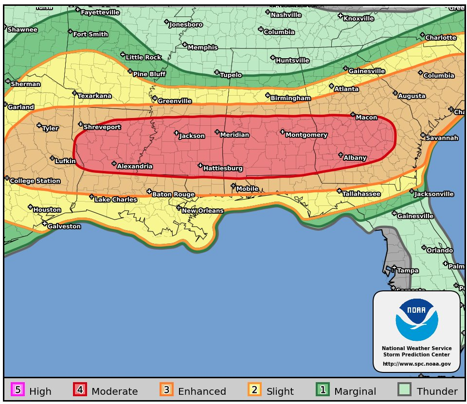
Just a week after a major severe weather outbreak hit portions of the eastern United States, another one is forecast to strike today. An outbreak of tornadoes and severe thunderstorms is expected today from parts of the lower Mississippi Valley across much of the the Southeast. In addition to tornadoes, many of the storms will have very large hail and wind damage. The severe threat will be greatest from north-central Louisiana eastward to southern and central Mississippi, southern and central Alabama into south-central Georgia. Additional severe storms with a threat for tornadoes, wind damage and hail will be possible in parts of east Texas this morning and in the Carolinas tonight.
Today’s outbreak comes just 1 week after 131 tornadoes touched down in this area. The Enhanced Fujita Scale or EF Scale, which became operational on February 1, 2007, is used to assign a tornado a “rating” based on estimated wind speeds and related damage. Based on the winds and damage, tornadoes are rated on a scale of EF-0 to EF-5. Over the April 12-13 outbreak, there were 27 EF-0, 69 EF-1 , 21 EF-2, 12 EF-3, and 2 EF-4 tornadoes touched-down. Georgia had the most tornadoes: 28. Alabama had 24, South Carolina saw 21, North Carolina has 16, Mississippi had 15, Louisiana has 15, Texas had 4, Maryland had 2, and Florida had 1. The combined total length of tornado paths for the outbreak was a stunning 903.28 miles. 33 people were killed while hundreds of homes and businesses were destroyed.
While many are sheltering-in-place due to the COVID-19 Pandemic, a place suitable for shelter for the virus may not be suitable for shelter from the severe storms. Before threats arrive, people should make sure they’re in a safe place to protect themselves from severe weather. If people are in places they aren’t used to due to COVID-19, they should review what they would do should destructive straight-line winds or tornadoes impact their place of shelter.
