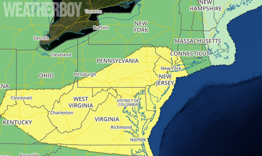
After a lull in the action today and tomorrow, it appears heavy rain and a renewed severe weather threat will return to the Mid Atlantic. The last several days have been rough, with widespread flooding, tornado warnings, and confirmed tornado and waterspouts in the Mid Atlantic; unfortunately, it appears more of the same is back in the forecast for Thursday. In their latest Convective Outlook for Thursday, the National Weather Service’s Storm Prediction Center has identified an area across the heavily populated I-95 corridor from Richmond, VA through Washington, DC, Baltimore, MD, and Philadelphia, PA to New York City, NY and points west as a risk area with a heightened threat of severe weather action.
Strong and locally severe storms are forecast to spread across the central Appalachians and mid Atlantic region and vicinity Thursday afternoon and evening. Larger-scale mid-level troughing is forecast to expand across the eastern US on Thursday, as a short-wave trough digs southeast across the Great Lakes area into the mid and upper Ohio Valley. At the surface, a cold front will shift southeast across eastern and southern portions of the country while high pressure prevails across the central and northern portions of the US.
Widespread precipitation is forecast to be ongoing across western and northern portions of the risk area, which, along with clouds streaming east ahead of the convection, should hinder diurnal destabilization across a large portion of the risk area. Still, with a belt of strong flow aloft expected to spread east across the region in conjunction with a lead short-wave trough ahead of the main system crossing the Great Lakes, any storms which can form would likely evolve into fast-moving bands, posing a damaging wind risk. This potential risk area would extend into Thursday evening and into the overnight hours early Friday.
In addition to the severe thunderstorm threat, there is also the chance of heavy rain and more flooding concerns. With ample atmospheric moisture to work with, some showers may be very heavy, especially over Delaware, southern New Jersey, Maryland, and northern Virginia on Thursday. Remember: turn around, don’t drown; never drive through flood waters.
