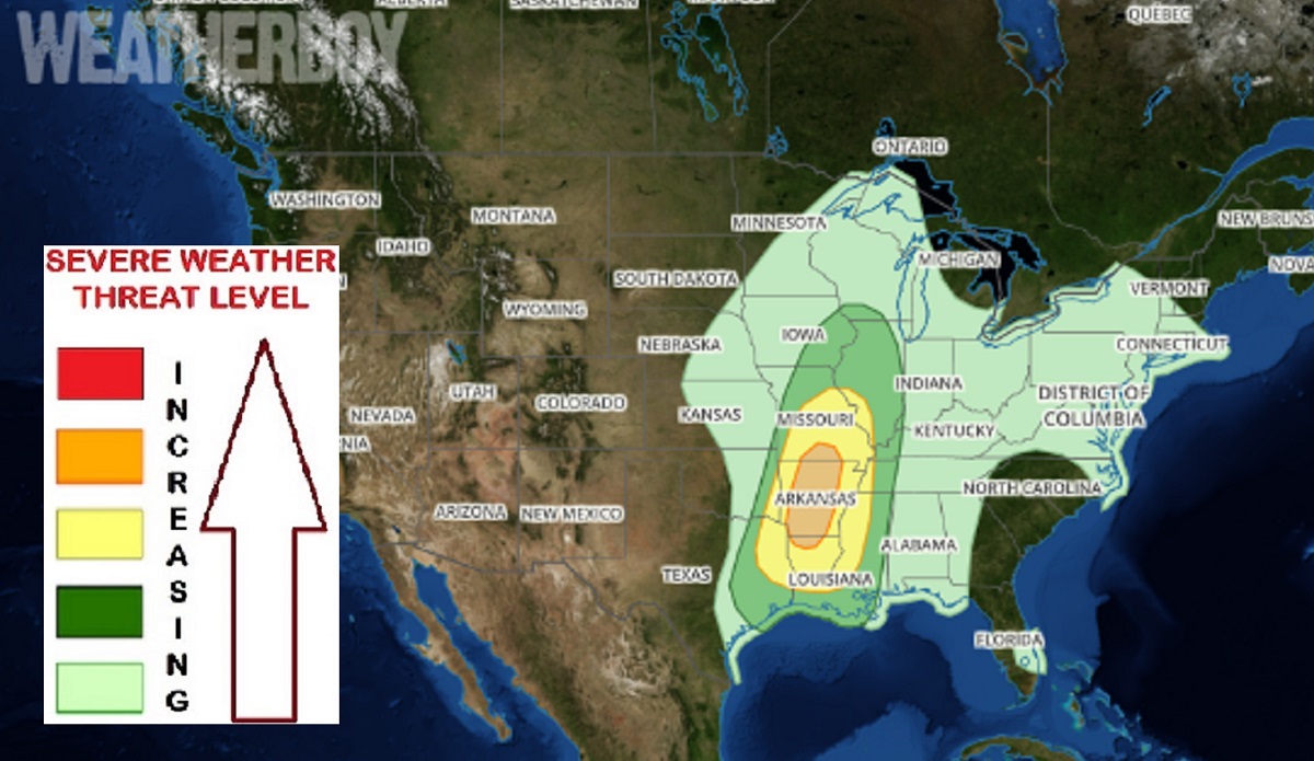
The National Weather Service’s Storm Prediction Center (SPC) is warning that a severe weather threat will return to portions of Arkansas, Missouri, and Louisiana on Saturday. In their latest convective outlook update, the SPC says atmospheric ingredients will come together to create the risk of very large hail, destructive wind gusts, and isolated tornadoes.
The most potent storm ingredients will assemble during the PM hours. At the surface, a low is forecast to move into the mid Mississippi Valley, as a cold front advances eastward across western Kansas and western Oklahoma during the morning. Ahead of the front, low-level moisture will return north into the Ozarks with elevated dewpoints in place by midday across most of the region. Thunderstorms are forecast to develop quickly ahead of the cold front during the early to mid afternoon along and near the instability axis. These storms may organize into a broken line, and move eastward toward the Mississippi River during the late afternoon and evening hours.
According to the SPC, this atmospheric environment should be very favorable for supercells with large hail. Hailstones greater than 2 inches in diameter will be possible with the stronger and more dominant supercells. The threat for very large hail is forecast to be greatest from southwest Missouri southward across much of western and central Arkansas, into northeast Texas and northwest Louisiana. Initially, the storms will likely be discrete resulting in the greater hail threat. However, a line of storms, along with a wind-damage threat, is expected to develop during the late afternoon. The line will move eastward toward the Mississippi River during the early evening, and will affect areas to the east during the overnight period. A tornado threat will be possible with supercells and bowing line segments.
On Sunday, this severe threat zone will shift south and east, with a new threat zone of severe weather possible over Georgia and South Carolina.
