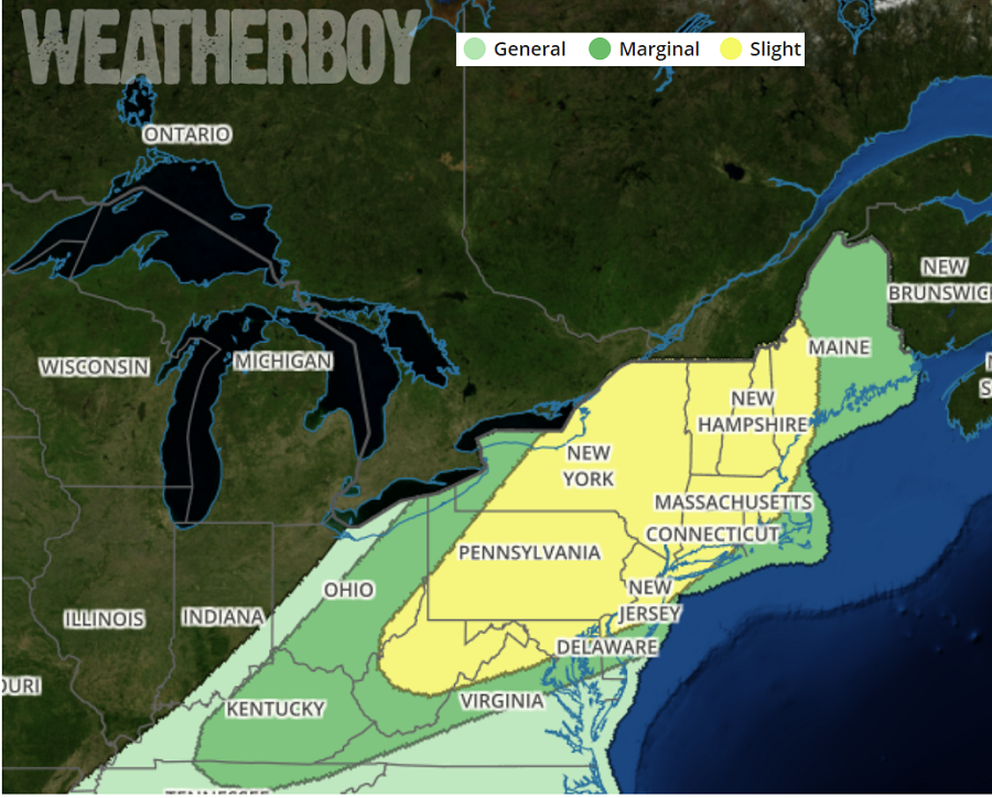
The National Weather Service’s Storm Prediction Center believes there’s a risk of severe thunderstorms in the northeast on Wednesday. Scattered thunderstorms associated with a wind damage threat are expected to develop on Wednesday from the central Appalachian mountains to the Northeast. According to the Storm Prediction Center, a tornado threat will also be possible from eastern Pennsylvania northeastward into New England.
A frontal system is responsible for the severe weather threat. An upper-level trough will move quickly eastward across the Great Lakes region on Wednesday. Today, a cold front will be located from southwestern Ontario, Canada extending southwestward into the Ohio Valley. This front will advance east-southeastward across the Northeast and central Appalachian on Wednesday. A line of thunderstorms is forecast to develop around the front and this line is forecast to gradually intensify during the day. Scattered thunderstorms will also be possible ahead of the cold front from the northern Appalachians southwestward across parts of the Mid Atlantic. Ahead of the front, surface dewpoints are forecast to be in the mid to upper 60s. This should result in weak instability across the central and northern Appalachians but a corridor of moderate instability will be possible in the lower elevations of the Mid-Atlantic. The moist airmass combined with strong winds just above the surface will be favorable for a wind damage threat with the faster moving line segments.
The potential for wind damage should be the greatest in eastern Pennsylvania, eastern New York and western New England where the combination of instability and low to mid-level flow is forecast to be maximized. A tornado threat may also accompany the more intense parts of the line, especially across western New England where the mid-level and low-level jets are forecast to be closer together.
Although strong deep-layer shear is forecast across parts of the central Appalachians, low-level flow should be much weaker with southwestward extent into parts of southern West Virginia and central to eastern Kentucky. For this reason, the wind damage threat is expected to be marginal across the southern portion of the central Appalachian Mountains.
The main period of concern is Wednesday into Wednesday evening in the risk zones ahead of the cold front. After that, the weather pattern should be relatively quiet for the balance of the week in this region.