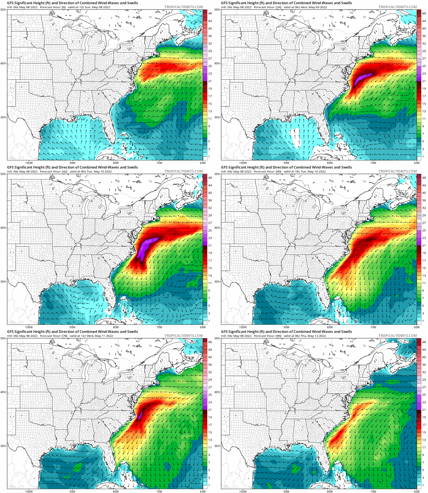
A significant coastal storm could become a tropical cyclone in the coming days, based on some computer forecast model data that suggests the meandering storm could take on some tropical cyclone characteristics as it drifts south and west towards the U.S. Southeast Coast. The storm is also playing havoc with cruise ships traveling up and down the U.S. East Coast; Royal Caribbean’s Oasis of the Seas and Norwegian Cruise Line’s Joy were caught in rough seas last night off of the Jersey Shore. Very large waves crashed over lifeboats and into cabins with balconies as high as Deck 7.
Passengers on board Royal Caribbean’s Oasis of the Seas, which is one of the largest cruise ships in the world, went on social media to describe their experiences as the ship entered Storm Warning-warned waters off the Mid Atlantic Coast. “Two of my sons and my husband threw up all night,” wrote Maggy Khairy on Facebook. Others described being unable to stand up in their cabin. “The massive bang s–t me up,” wrote Matthew Smith. “When I looked off the balcony and holy s–t!” Smith joined in others wondering why they didn’t hear more messages about the storm on-board. “How come there’s no messages from the bridge or the staff about the storm?”
An intercom announcement was made on the ship’s fourth deck at around 10pm, with crew personnel urging people to “grab onto some thing or some one” for safety.
Storm force winds & surf continue to batter @RoyalCaribbean #OasisOfTheSeas, where their pool deck pools are experiencing mini-tsunamis as it heads directly into a significant Storm Warning-warned coastal storm off the southern New Jersey coast. #NJwx pic.twitter.com/JQNnJ3x2WN
— the Weatherboy (@theWeatherboy) May 8, 2022
The Oasis of the Seas safely returned to port in Bayonne, New Jersey early this morning. However, it is planning to set out to sea again later this afternoon. Royal Caribbean Chief Meteorologist James Van Fleet said on Twitter that the coastal storm could impact the path this next cruise takes, including the potential elimination of a scheduled port stop at Florida’s Port Canaveral.
The storm system is an unusually potent low pressure system more common in the fall and winter than in May; in addition to dropping heavy rain and whipping portions of the eastern U.S. with strong winds, the storm is also bringing down unusually chilly air for this time of year.
Computer forecast guidance suggests the storm will slowly head south and east before drifting due south. From there, later this week, the storm could drift to the west, impacting portions of the southeast coast. Before its rendezvous with the coast, there’s a chance the system could take on tropical cyclone characteristics –especially as it moves over the warm waters of the Gulf Stream. Tropical storms and hurricanes aren’t completely unheard of in May even though the Atlantic Hurricane season doesn’t officially kick-off until June 1.
Whether or not a tropical cyclone takes shape, conditions along the coast will remain rough with high seas, beach erosion, and pockets of coastal flooding. Should a more substantial cyclone form, those conditions could become even worse and more severe.