A significant ice and snow event is likely to unfold in the northeast as the work and school week comes to an end, with heavy wintry accumulations expected.
A complex weather system is to blame for the wintry weather; before it arrives, a spring tease needs to wrap-up. While today wasn’t the most typical February day with temperatures rising into the 50s and 60s across portions of the Mid Atlantic, a change to more February-like conditions is coming. The warm air advection tied to today’s weather will end as a nearby area of low pressure moves north and a nearby stronger low-level jet moves off-shore. Wednesday will also feature much warmer than average temperatures in the Mid Atlantic. But during the afternoon, an approaching cold front will cut off the opportunity for more warming. Cold advection will strengthen behind the front on northerly winds Wednesday night as a high pressure system from the Arctic moves in over the Great Lakes.
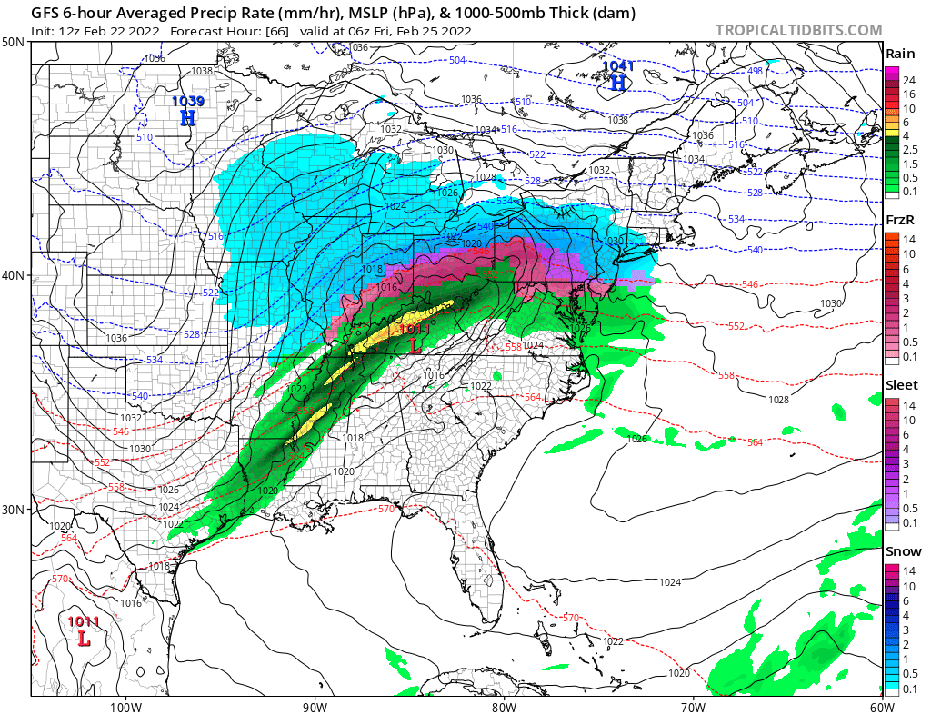
With cold air in place, a primary low pressure system will move through the Tennessee Valley north and east towards western Pennsylvania by Friday morning as a secondary system develops off of the east coast. While those two lows spin about, Arctic high pressure will remain banked to the north in New England, setting the stage for a variety of precipitation types in the eastern U.S.
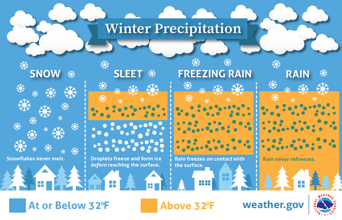
It appears the heavier precipitation will spread into the eastern U.S. on Thursday evening, spilling over into Friday morning before wrapping up in time for the weekend. With cold air locked in place, snow is expected to break out over most of Ohio, Pennsylvania, and New Jersey at the start of the storm. But as milder air runs north ahead of this next low, snow will change to freezing rain and sleet in central portions of Ohio, Pennsylvania, and New Jersey as plain snow spreads into southern New England. On the south side of the system, rain will become the dominant precipitation type while snow remains the dominant precipitation type in the north. But in the middle, an icy mess will be the dominant precipitation type with a prolonged period of sleet and freezing rain expected there.
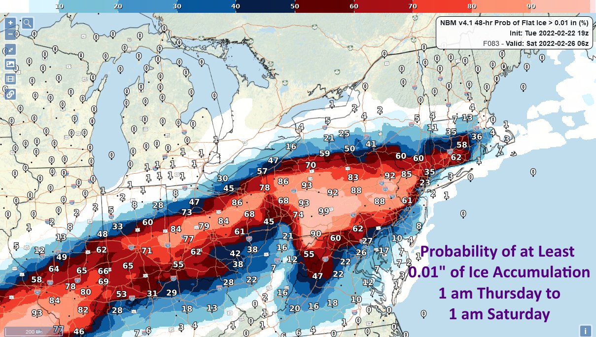
Accumulating ice is likely across central Ohio the northern two-thirds of Pennsylvania, northern New Jersey, southern Upstate New York, and southern Connecticut. Odds are high here that at least 0.01″ of ice will accumulate. Unlike snow, just a tiny ice accumulation could create major travel headaches and dangers, especially on untreated surfaces.
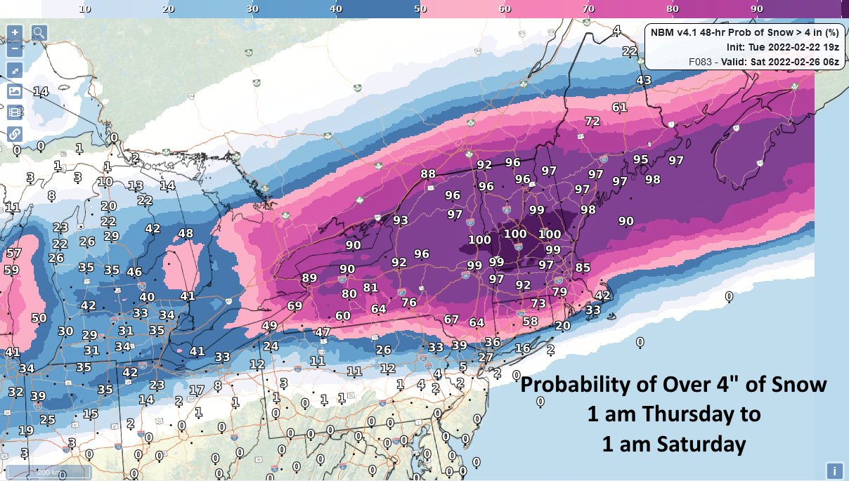
North of the ice where cold air should be locked in at most layers of the atmosphere, snow will fall, heavy at times. There’s nearly a 100% chance of more than 4″ of snow over portions of central eastern New York state, southern Vermont and New Hampshire, and southeastern Maine. In this area, more than 8″ of snow could fall before it wraps up late Friday.
By Friday, the center of this complex system should move near Philadelphia and New York in the morning with the secondary low taking over and pulling away to the northeast by the afternoon. As such, precipitation will gradually wind-down during the day on Friday.
Behind the storm, winds will increase during the mid and late afternoon hours as the low pulls away. Northwest gusts of 25-35 mph are possible in the northeast; when ice and snow accumulations are factored in, there could be power outages from trees and wires stressed by the wintry weather.
Fair high pressure will return for Saturday, kicking off the weekend on a fair but chilly note.
