A significant nor’easter is expected to impact the northeastern United States this week, bringing wind-whipped rains, strong winds, beach erosion, and the threat of coastal flooding to a large area. While Gale Watches and Warnings have been posted for the coast, the National Weather Service has issued Flash Flood Watches for much of New Jersey, all of Long Island and the metro New York City area, southeastern New York, all of Connecticut and Rhode Island, and most of Massachusetts.
A rapidly deepening closed low south of New England will bring about a many weather threats. However, there is still uncertainty with some forecast specifics; the exact track of the closed low and its wind and moisture anomalies are still being calculated.
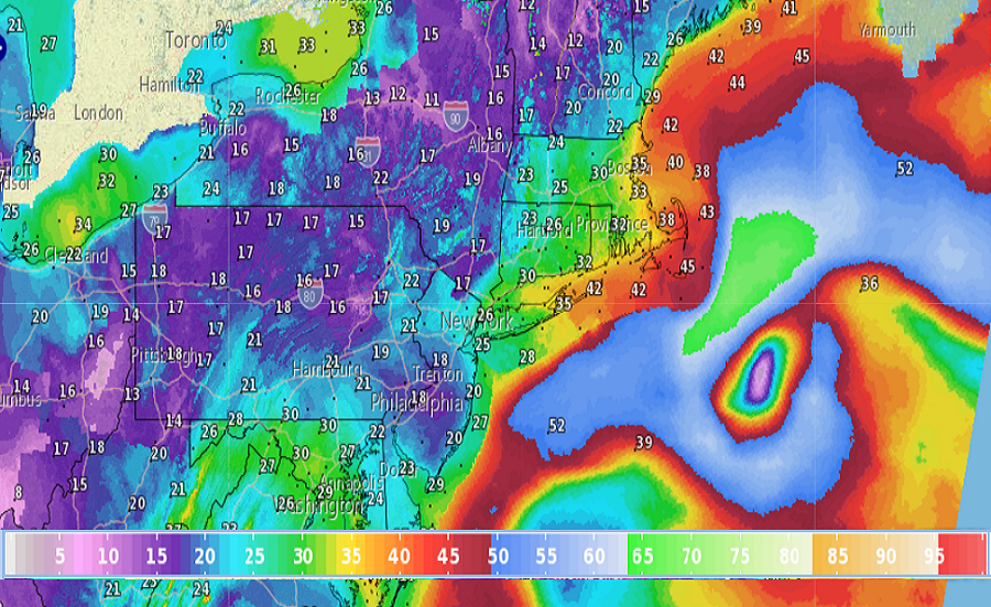
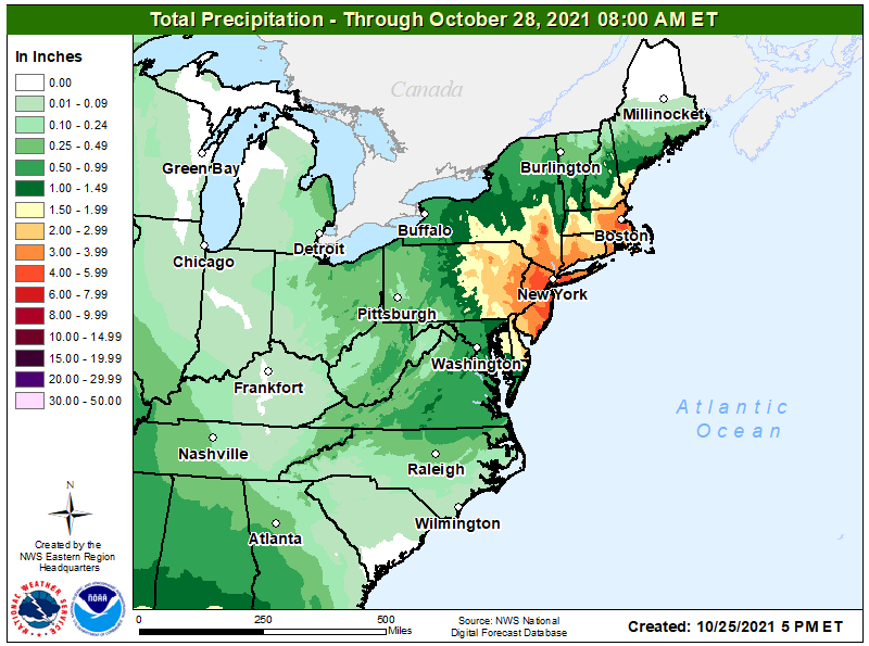
With anomalous wind and moisture anomalies with combined with a closed vertically stacked low south of New England will likely bring very heavy rainfall to the region. It appears as much as 2-3″ of rain could fall over a 6 hour period late Tuesday in portions of the northeast, with storm totals of 2-6″ of rain possible over the broader northeast. Heavy rain will begin to overspread the region in the morning from south-southwest to north-northeast. Right now, it appears the heaviest rainfall likely will be across the hilly terrain of Connecticut and Rhode Island and into the Worcester Hills, as strong east-northeast inflow provides upslope rainfall
enhancement.
According to the National Weather Service, all model guidance has a strong low level east-northeast wind anomaly pivoting into southern New England on Tuesday, with wind gusts as high as hurricane force possible being suggested by some computer guidance. Model soundings support 50-60 mph winds possible across Rhode Island and eastern Massachusetts, with 60-70 mph gusts possible on Cape Cod and the Islands. Due to this, high wind watches have been issued there. Strong winds are likely south across Long Island and coastal portions of New Jersey, Delaware, Maryland, and Virginia, with gusts over 30 mph expected there. Because many trees remain fully leaved, there could be considerable tree damage and power outages from this storm.
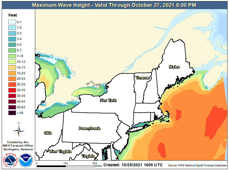
The strong winds will whip up surf, creating a variety of problems at the coast. Strong winds sustained over several days will help drive large waves, many of which will crash onto the coast. Around Cape Cod, some waves could be greater than 15′ in height at the coast. Waves over 5′ tall can impact the coast elsewhere from Virginia to Maine, creating dangerous surf for swimmers, surfers, and boaters as well as create beach erosion. With a prolonged on-shore flow, coastal flooding is likely. The National Weather Service reminds people: “Turn around, don’t drown; never drive through flood waters.”
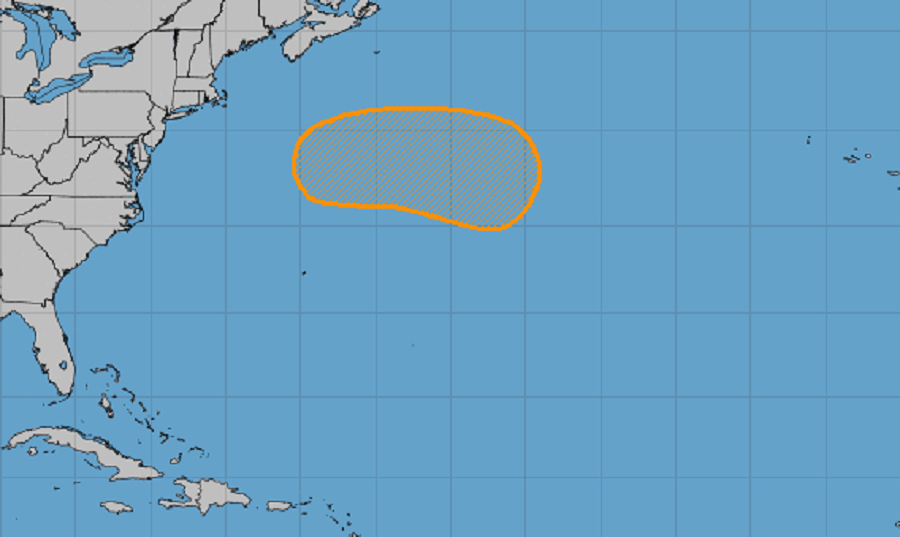
As the storm spins about off the coast, the National Hurricane Center says it may take on tropical or subtropical cyclone characteristics. Initially, this strong storm will start as a non-tropical low pressure system off of the east coast of the United States. Later this week, this system should begin to move eastward away from the U.S. coast; by the end of the week, the low could acquire some tropical or subtropical characteristics while it moves eastward or southeastward over the central Atlantic. If it were to become named, it would be called Wanda which is the last name on the list of 2021 tropical storm names to use for the season. Even if it develops into a named storm system, it should move away from the U.S. over time.
