A significant river flood threat is returning to the Mid Atlantic this week, prompting cautionary warnings and statements from the National Weather Service. The National Weather Service’s Mid Atlantic River Forecast Center says there’s a threat of significant river flooding in much of the eastern half of Pennsylvania, extreme northern Delaware, most of northern and central New Jersey, the western half of Maryland and Virginia and eastern West Virginia.
A frontal system is forecast to slide across the eastern United States from late Wednesday through late Thursday. While computer forecast models continue to feature differences in the speed of the front, and in turn, the timing of the precipitation and other impacts, models are in good agreement that a period of moderate to heavy rainfall is expected. The heaviest of the rain is expected to fall during the day Thursday into Thursday night, soaking an area that has been soaked in recent weeks by torrential rains from tropical cyclones.

An area of low pressure will develop near the Ohio River Valley Tuesday night into Wednesday along a cold front as it moves eastward. As the mid-level low closes off Wednesday and drifts northward through the end of the week, the surface low will meander north across the Great Lakes. Because of this movement, the frontal progression will slow as it moves to the East Coast, resulting in the heavy rains. The front is expected to eventually move across the east coast by Thursday night, with fair weather returning in time for the end of the week.
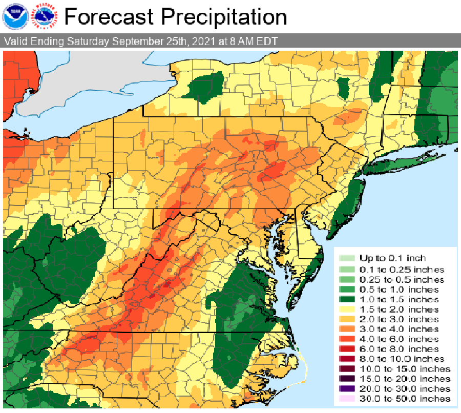
In addition to heavy rain, there could also be severe thunderstorms. Some storms could blossom on Thursday; such storms could also become very efficient rainmakers in a very short period of time, resulting in flash flood threats. River flooding is also possible with upwards of 2-4″ of rain possible in locations. Isolated 4-6″ amounts are possible in the mountains of Pennsylvania and West Virginia.
