While the East Coast is dealing with frigid Arctic air, the people in Hawaii are dealing with their own winter weather problems. And while many don’t associate the Aloha State with snow, a lot of it appears to be headed to Hawaii where Winter Storm Watches have been posted for a foot or more of snow this weekend.
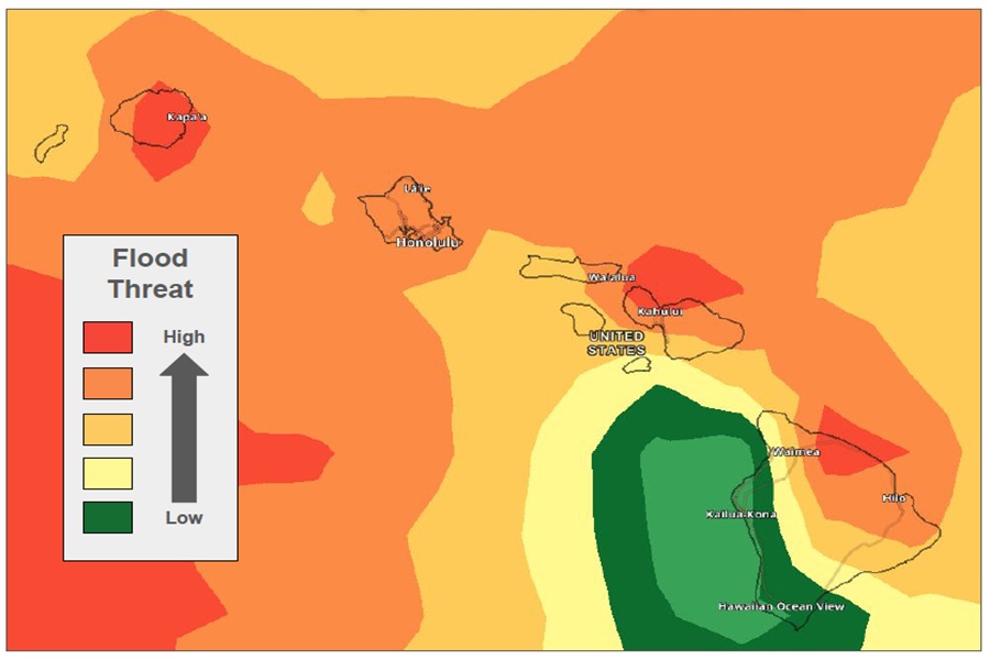
According to the National Weather Service on the island of Oahu in Honolulu, a cold front will move into the island of Kauai by this evening, then slow and stall near Maui and Lanai islands on Saturday. This frontal boundary, combined with increasing moisture and a disturbance aloft, will bring the potential for heavy rainfall, flash flooding, and a few thunderstorms from Saturday afternoon through Monday.

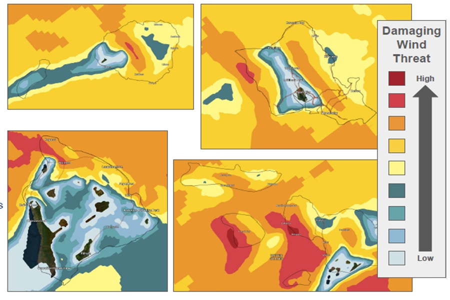
Breezy north to northeasterly winds will develop behind the front, then the trades will become very windy late Sunday into Monday as strong high pressure builds well north of the state and interacts with a deepening trough to the west. During this process, some damaging wind gusts are possible around the state.
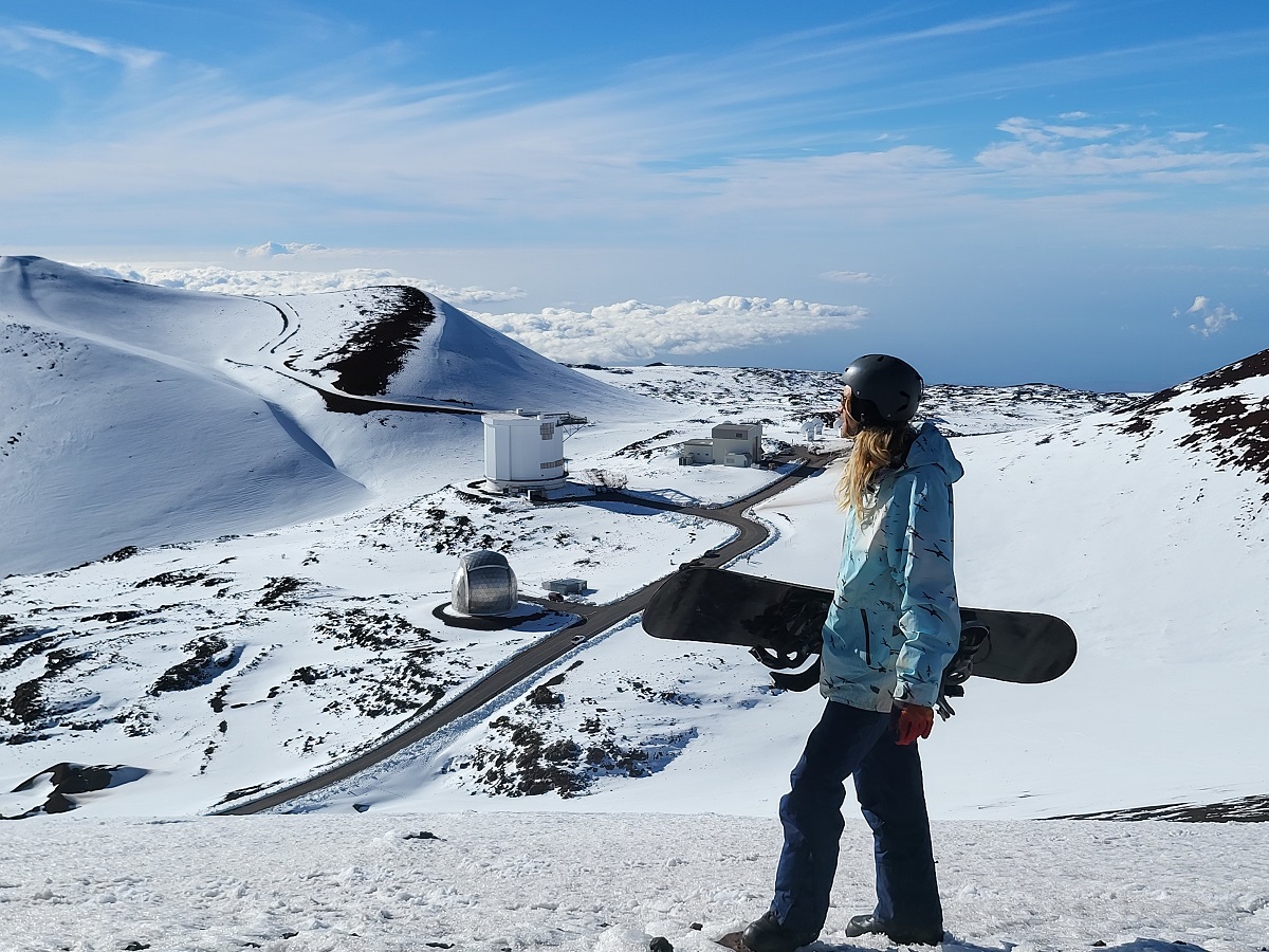
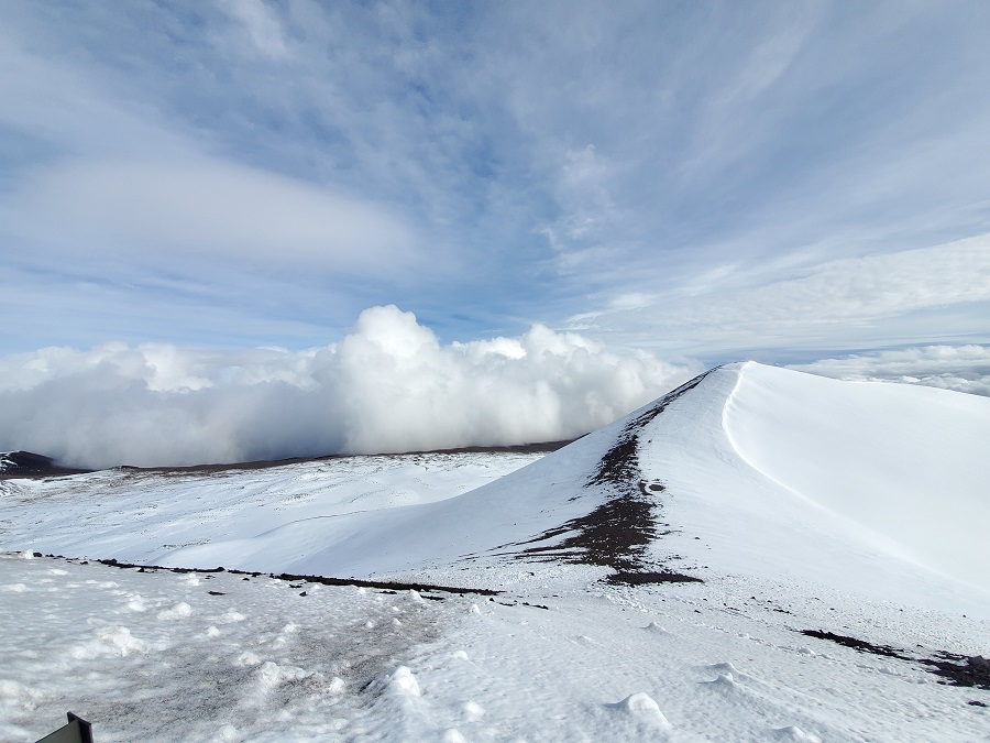
While most people don’t associate the tropical paradise Hawaii is known for with snow, they’re surprised to learn that it does snow in the winter due to the elevation of its volcanic peaks. Mauna Kea is the highest of the bunch at 13,803 feet. Maui’s Haleakala is much lower at 10,023 feet. Because of that difference, Hawaii Island will see snow more frequently than the lower peak of Maui Island. Just one storm in January 2020 dropped 2-3 feet of snow on Hawaii Island and created snow drifts that were far deeper. Another storm in 2021 brought snowboarders and skiers out to the mountain by the dozens. It appears the Big Island of Hawaii summits will be subject to winter weather conditions as this storm moves through.
Conditions will gradually improve by mid to late next week, although breezy and occasionally showery trade wind weather is expected to persist.
A variety of advisories have been posted by the National Weather Service to warn people of the impending hazardous weather.
A Winter Storm Watch is in effect for Big Island Summits above 11,000 feet. The National Weather Service warns, “Travel could be very difficult to impossible. Blowing snow will significantly reduce visibility at times, with periods of zero visibility.” More than a foot of snow is expected there.
Elsewhere throughout the rest of the state, a Flood Watch is in effect. Flood prone roads and other low lying areas may be closed due to elevated runoff and overflowing streams. Urban areas may receive more significant flooding and property damage due to rapid runoff.
A High Wind Watch is also in effect from Sunday morning through to Monday afternoon because of east winds of 25 to 40 mph with the potential for damaging gusts over 60 mph possible. The High Wind Watch is up for portions of Kahoolawe, Kauai, Lanai, Maui, Molokai, Oahu, and the Big Island of Hawaii. Areas most at risk include higher terrain, passes, and areas immediately south and west of the mountains.
