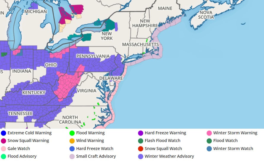
A forecasted snow event has prompted the National Weather Service to issue Winter Storm Watches and Winter Weather Advisories for portions of Ohio, Pennsylvania, New Jersey, Delaware, and West Virginia, where up to 6″ of snow could fall. While some areas could see a half foot, especially in the higher terrain of west-central Pennsylvania and West Virginia, most other areas will see generally light 2-4″ snowfall amounts. While this will be the second snow event for this region this week, it’ll likely be the last for January. The weather pattern is expected to turn milder, turning off the possibility of snow at least through early February.
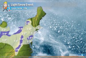
Another round of light snow is likely for portions of Pennsylvania and New Jersey from another weather disturbance forecast to move through the region at the end of the week. A weak shortwave trough approaching in the flow aloft will generate snow flurries throughout the Great Lakes and portions of the northern Mid Atlantic late tonight into Friday; that shortwave will initiate a coastal low off the Carolinas around midnight Thursday which is forecast to move east-northeast off of Cape Hatteras by Friday morning. Meanwhile, a much stronger shortwave will be tracking quickly east-southeastward from the northern Plains early Thursday, to the Mid-Atlantic on Friday. As it does so, some degree of phasing with the cold upper-trough dropping southward across the Great Lakes is expected to occur.
According to the National Weather Service, just how much phasing and resulting amplification occurs is key for determining how much snow will fall on Friday in the East. If the initial shortwave and surface low dominates and keeps the stronger thermal gradient and baroclinic zone shifting offshore while the better upper-level dynamics are a step behind, there may only be several hours of light snow with perhaps an inch or so. If the stronger shortwave can amplify and back the flow near the coast to allow a surface low to hold closer to the coast, and increase frontogenetic forcing for a time on Friday, then several inches of snowfall will be possible.
This system will be a quick mover, with the bulk of any snow falling during the daytime hours on Friday and ending early Friday evening, followed by a very cold night, with wind chills possibly nearing or even dropping below 0F throughout portions of the Mid Atlantic.
As we head into the new week next week, conditions will moderate and the weather pattern will become more zonal. Long term guidance suggests it’ll linger for the next week or two, which will shut-down the ability for the region seeing light snow Friday to get any more this month.
