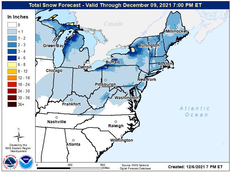
A relatively weak coastal low will set the stage for snow showers across portions of the northeast later tomorrow into Wednesday, producing light accumulations of snow as it moves through the region.
During the night tomorrow, the low will be strengthening offshore of the North Carolina coast prior to lifting to the northeast through the day Wednesday. While some computer forecast models called for a more robust system closer to the coast, it appears this will be a relatively weak and light event too far from shore to create significant impacts. Even know, forecast models disagree with how weak the system will be. The European ECMWF computer forecast model remains the farthest east with the low as it passes by the northeast coast, producing the least impacts to the U.S. Meanwhile, other guidance, such as the American GFS computer forecast model, tracks the low farther to the west with slightly more impact. Either way, precipitation should be light with the greatest amounts close to the I-95 corridor between Philadelphia and Boston.
According to the National Weather Service, the greatest lift and moisture combination within the dendritic snow growth zone will remain on the northwest side of the low, which will track across most of eastern Pennsylvania, New Jersey, as well as Delaware and eastern Maryland. This means most of the light snow will begin in this area just before or around sunrise Wednesday as a weak lead shortwave moves into the region. A stronger short wave should approach from the west after sunrise, with light precipitation breaking out throughout the Mid Atlantic and Northeast. Temperatures will be close to freezing, creating marginal snow accumulation conditions. As such, most places will see an inch or less of snow although up to 2″ is possible near the I-95 corridor, especially in southern and central New Jersey, eastern Connecticut, and eastern Massachusetts.
Light snow will reduce visibility and people traveling on roads should drive with care and caution. While significant accumulations of snow aren’t expected, even a small amount of snow could make for slick spots on untreated surfaces. Because snow and winds will be on the light side, significant impacts to aviation are unlikely at airports around Philadelphia, New York, and Boston.