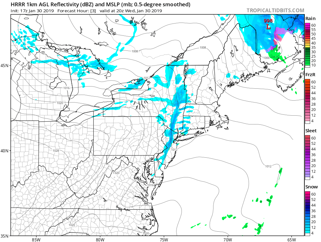
A reinforcing cold front bringing a fresh blast of polar air to portions of the Mid Atlantic and New England will trigger a brief snow squall this afternoon. The latest weather RADAR indicated snow squalls and snow showers moving into southeastern Pennsylvania from the west. This area of snow will consolidate into a squall line with brief but heavy snow and strong winds. Snow squalls will be accompanied by wind gusts in excess of 40mph and the visibility will drop briefly to a half mile or less. It’s also possible that a quick inch of snow may accumulate. The reduced visibility and the snow will create hazardous travel conditions. The National Weather Service warns, “Use extra caution if you must travel into or through these snow squalls and snow showers. Rapid changes in visibility and potentially slick roads are likely to lead to accidents. Consider delaying your travel until the snow passes your location.”
The secondary surface low system which spawned over the Mid Atlantic yesterday will continue to progress north into Maine and the Canadian Maritimes this afternoon. Behind this system and ahead of the Arctic high pressure located over the Great Lakes, pressures will fall as an Artic front pushes east. While winds will gust to 40mph in areas of the snowsquall, gusts to or over 50mph can’t be ruled out either. The squall line should exit the Jersey Shore by 4pm but will continue to march across Long Island and eastern New England into the evening hours.
As this Arctic front moves through, temperatures will get progressively colder this afternoon and evening. Not only will it be cold, but strong pressure rises combined with strong winds aloft and modest atmospheric mixing will make for gusty winds through the afternoon and into the evening.
While the snow squalls will create short-term travel headaches, the big story will remain the bitter cold air. Even at coastal locations of the Mid Atlantic, low temperatures tomorrow morning will be in the single digits, with readings below zero inland north and west of the I-95 corridor. Combined with the influence of the wind, it’ll feel like -10 to -15 across most areas, with wind chill factors of -20 to -30 possible in higher elevations of the northeast. Because of this, the National Weather Service has issued a Wind Chill Advisory for tonight into Thursday for points north of the DelMarVa Peninsula.
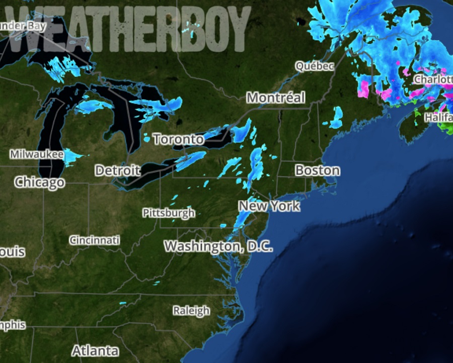
The squall line can be tracked in real-time on Weatherboy Weather RADAR here.
