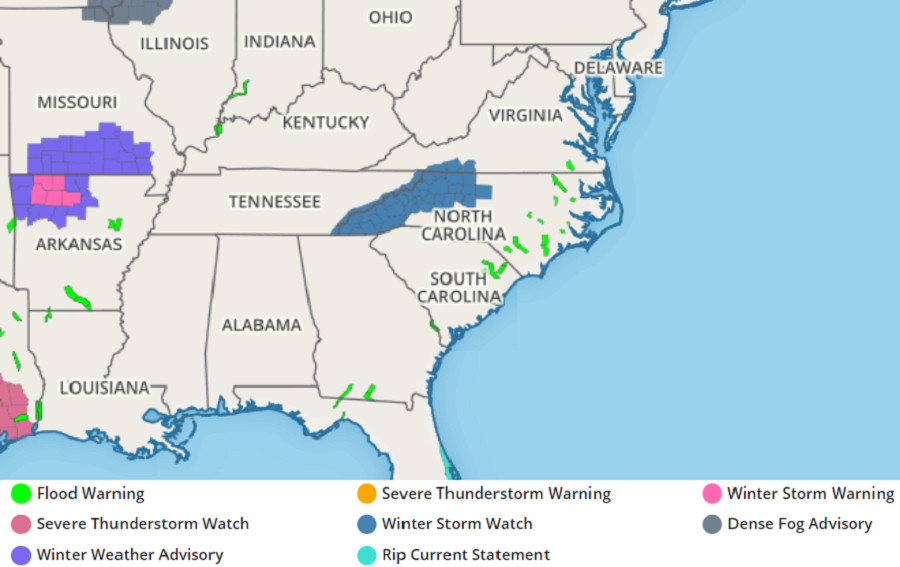
A snowstorm is now likely across portions of the southern Mid Atlantic, prompting the National Weather Service to issue Winter Storm Watches there. While Winter Storm Warnings and Winter Weather Advisories are up now for portions of Missouri and Arkansas.
A strong, closed upper low low will push into the southern Appalachians from the west tomorrow evening. At the same time, a deepening surface low will slide east and then northeast from southern Alabama to just off the North Carolina coast. A conveyor belt of moisture will follow the cyclonic flow of these systems along and near an occluded front, with precipitation overspreading the southern portions of the Mid Atlantic region Thursday night. Precipitation will pick-up with intensity early Friday; more intense precipitation will also help bring down a more substantial cold air mass closer to the surface, expanding the area that could see snow.
Snowfall totals are expected to be generally 2-4″ across the mountains with locally 8″ possible along the ridge tops. In the North Carolina foothills and most areas north of I-40, 1-3″ is expected. Some snow is possible as far south as I-85, where even there a light dusting is possible before the system exits.
This storm system will head out to sea from the North Carolina coast. Because it won’t come north up the coast, no snow, or any precipitation for that matter, is expected across the northern Mid Atlantic or New England regions.