Another coastal storm will bring wind-whipped rain to the northeast tomorrow, bringing much needed rain to an area that has been very dry for the last several weeks. However, the moderate to heavy rainfall will also be joined by strong wind gusts. The combination of soaking rains and gusty winds could lead to power outages from New Jersey into Maine.
A frontal boundary draped across the Gulf Coast states will slowly lift northward, with showers and thunderstorms likely from the Lower Mississippi Valley to the Southeast on Tuesday. Locally heavy to excessive rainfall is possible. Another system advancing through the Midwest on Tuesday will bring rain and storm chances along and ahead of the cold front. This will push through the Ohio Valley and into the East by Wednesday, while the cold front sinks towards the Gulf Coast. Over the Carolina coastal plain, low pressure is forecast to deepen rather quickly off the Mid-Atlantic coast, reaching a position near or just off the New England coast by Thursday morning. This storm system will bring heavy rainfall and gusty to possibly storm force winds from portions of the northern Mid-Atlantic to New England Wednesday night into Thursday.
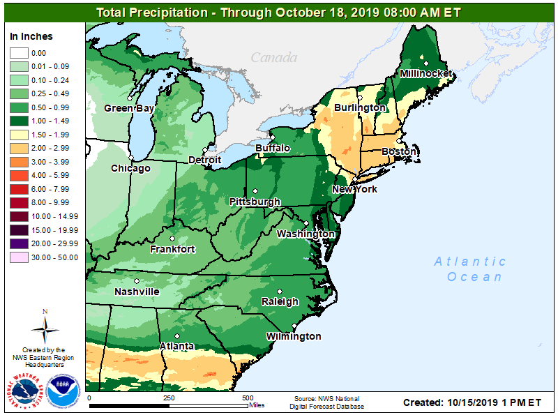
It appears the heaviest rains will be over upstate New York, southern Vermont and New Hampshire, Connecticut, and Massachusetts. Here, upwards of 3″ could fall with widespread 1.5-2.5″ amounts expected. More than an inch is expected throughout much of New Jersey, eastern Maryland, Delaware, and northern Maine.
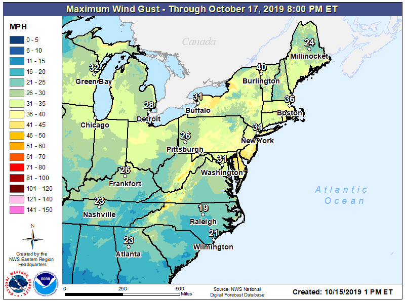
The strongest wind gusts could be over New Jersey, where widespread gusts over 40mph are possible. Wind gusts over 30mph are expected over much of the Great Lakes, Northeast, and Mid Atlantic regions. Gusty winds could lead to power outages; people are urged to prepare for that possibility ahead of the storm’s arrival tomorrow.
While it won’t be as bad as Subtropical Melissa’s impacts were just days ago, another round of rough surf, beach erosion, rip currents, and coastal flooding is likely as the storm rapidly intensifies in the off-shore waters southeast of New England. The worst conditions should be later Wednesday into Thursday.
On Thursday, conditions will improve from southwest to northeast as dry high pressure returns to the region.
