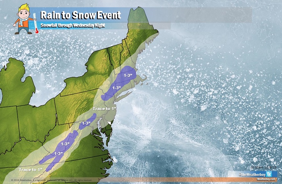
A soaking rain storm will continue to bring rain to portions of the eastern U.S. today and tomorrow. Tomorrow, ahead of a cold front’s arrival, temperatures will surge up, with some readings in the low 70’s as far north as the DelMarVa Peninsula. However, when that cold front pushes through later Tuesday into Wednesday, it’ll boot the mild air out to sea and change lingering precipitation over to snow.
While places like Washington, DC, Philadelphia, PA, and New York City, NY will see snow flakes fly on Wednesday, not much in the way of accumulation is expected. With mild, wet surfaces from the previous day, snow will struggle to accumulate there. However, some bursts of snow could be heavy at times; while accumulations of consequence likely won’t occur there, visibilities could drop significantly creating some travel problems.
In areas further inland, pockets of 1-3″ snow are possible in portions of North Carolina, Virginia, Tennessee, Kentucky, West Virginia, Pennsylvania, New Jersey, New York, Connecticut, New Hampshire, and Massachusetts. An isolated 4″ is also possible on the highest terrain in those areas. While driving won’t become impossible, it could become hazardous at times.
Much colder air will arrive Wednesday night into Thursday, helping freeze any untreated wet surface.