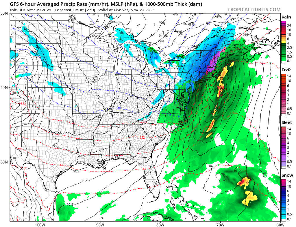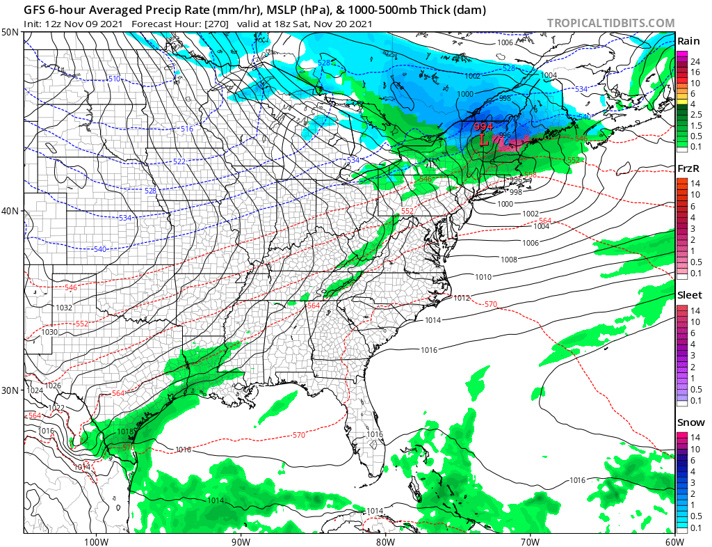
Some computer forecast model runs that meteorologists use to aid in their forecasting are suggesting the possibility that Thanksgiving Week may kick-off on a wintry note, with the possibility of a snowstorm developing in the northeast. However, because November features a month of significant transition in the weather world as milder fall conditions become replaced by colder winter ones, one shouldn’t put too much stock in forecast guidance so far out at this time.
“Weather models occasionally develop systems a week or two out that look quite alarming, but ultimately never materialize,” says National Weather Service meteorologists in Aberdeen, South Dakota today. “Subsequent runs show shifts or weakening, other models may have nothing at all.”
While meteorologists have many tools at their disposal to create weather forecasts, two primary global forecast models they do use are the ECMWF from Europe and the GFS from the United States. While the models share a lot of the same initial data, they differ with how they digest that data and compute possible outcomes. One is better than the other in some scenarios, while the opposite is true in others. No model is “right” all the time. Beyond the ECMWF and GFS models, there are numerous other models from other countries, other academic institutions, and private industry that are also considered when making a forecast.
Last night, the American GFS forecast model suggested that an area of low pressure will develop along the Mid Atlantic and become a potent area of low pressure as it heads to the northeast. If that run of the computer model were to actually verify, snow would fall from Pennsylvania and New Jersey to Maine and New Hampshire, with some significant accumulations possible over portions of New England.

However, this afternoon, the same model has suggested a different scenario, which would bring accumulating snow to northern portions of New England but not much else to the south. Portions of the Mid Atlantic, especially the south Mid Atlantic, could even remain dry if this model run were to verify.
Forecast models are also suggesting a weaker, lighter wintry weather event moving through portions of the Great Lakes and Northeast early next week. While not nearly as significant as what some model runs suggest will happen in the days leading up to to Thanksgiving, it is still important to monitor that system too.
Other than being aware and being typically prepared for any winter weather, there is nothing else that should be done but wait …until forecasters have a better handle of how these storm systems will evolve in the coming days and week.