The mighty blizzard that broke snowfall records in Denver and elsewhere in Colorado and Wyoming won’t be so mighty as it advances east; some light snow and/or sleet is possible in portions of the Mid Atlantic and New England tomorrow into Wednesday, but it won’t be anything like the epic winter storm that struck the West over the weekend.
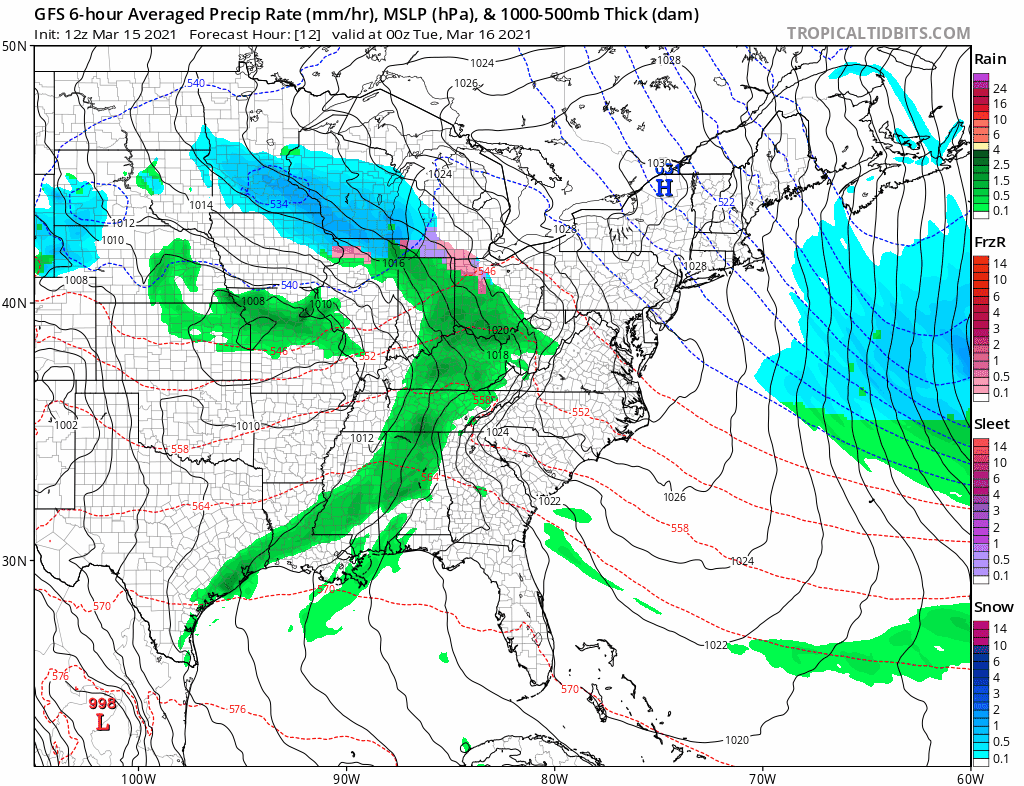
An area of low pressure will push through the central Mid Atlantic overnight Tuesday while a weak trough will extend to the north into the northern Mid Atlantic and southern New England regions. With some enhanced low level moisture combined with a few weak short wave/vorticity impulses, light precipitation is expected to break-out. With a marginal thermal profile, a wintry mix will develop across New York, Pennsylvania, New Jersey, Virginia, Maryland, and West Virginia. Some of the typically colder locations could see light freezing rain at times, but most precipitation should be light snow or a mixture of light snow and light rain. Closer to the coast, simply plain rain will fall.
The low is forecast to drift east through the day Wednesday, bringing the surface trough with it too. As a result, any lingering precipitation around Wednesday morning will quickly taper off. With dry high pressure arriving, albeit briefly, the balance of Wednesday should be dry before the next system arrives later Thursday.
Before all is said and done, an inch or two of snow could accumulate across portions of northern Pennsylvania and New Jersey, Upstate New York, western Connecticut, and portions of West Virginia, Virginia, and western/central Maryland. The heavy snow that fell across the west will not materialize in the eastern U.S. as this storm slides across the country.
A 72hr snowfall loop of the major winter storm conveys its mammoth scale. Not only did parts of southern WY and northern CO receive 3+ feet of snow in 48hrs, @NWSCheyenne broke their 2-day snowfall record and @NWSBoulder reported Denver had its 4th biggest snowstorm since 1881! pic.twitter.com/z01P0ZICoq
— NWS Weather Prediction Center (@NWSWPC) March 15, 2021
