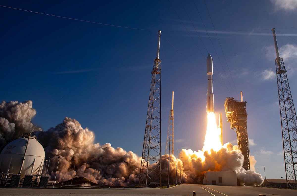
A United Launch Alliance (ULA) Atlas V rocket lifts NOAA’s newest weather satellite into space on March 1. Image: ULA
At 4:38 pm ET on Tuesday, NASA successfully launched NOAA’s newest weather satellite, which will eventually be named GOES-West, into space. Known simply as “GOES-T” from the GOES-R series of satellites for now, the Geostationary Operational Environmental Satellite (GOES) was lifted into space atop a United Launch Alliance Atlas V rocket from Cape Canaveral Space Force Station on the Florida space coast.
“We at NASA are proud to support our joint agency partner, NOAA, and their mission to provide critical data and imagery to forecasters and researchers tracking hazardous weather,” said NASA Deputy Administrator Pam Melroy. “While the GOES-R series satellites’ main job is to help with weather prediction, these satellites produce observations that also help with NASA science. Our agencies’ collaboration brings great benefits toward understanding our planet.”

“We at NASA feel honored to continue to work with NOAA on this strategic and successful partnership. Besides our work on spacecraft development and launch, NASA supported science teams are looking forward to analyzing the precious data that GOES-T will provide,” said Thomas Zurbuchen, the associate administrator for the Science Mission Directorate at NASA Headquarters in Washington. “These observations are a key part of our research towards improving understanding and models of climate, weather, and space weather – models that, in turn, support NOAA’s crucial work as they lead the weather and space weather forecasts for the nation.”
“This launch continues a 48-year history of NOAA, NASA, industry, and academia working together on geostationary satellite observations,” said John Gagosian, director of NASA’s Joint Agency Satellite Division. “GOES satellites help us every day. They bring advanced new capabilities to help forecasters better monitor and predict dangerous environmental conditions like hurricanes, thunderstorms, floods, and fires.”
GOES-T is the third spacecraft in the Geostationary Operational Environmental Satellites (GOES)-R Series, which NOAA officials describe as “the Western Hemisphere’s most sophisticated weather-observing and environmental-monitoring system.” After the GOES-T gets to space, it will be re-named GOES-18 as it achieves its geostationary orbit about 22,300 miles above the Earth’s surface. After testing systems on the satellite, it will eventually become operational as GOES-West and cover the central and eastern Pacific including all of Hawaii and the U.S. West Coast.
The GOES-T / GOES-18 will replace GOES-S / GOES-17 that is currently tackling the position of GOES-West. The previous weather satellite has suffered from a malfunctioning imager that’s unable to properly cool when hit by sunlight. When GOES-T arrives in space and eventually becomes functional and operational as GOES-West, the malfunctioning satellite would be put into “space storage” where it could become activated as a back-up should there be a failure of another weather satellite.
The first of the GOES-R series to be launched is operating as GOES-East; it is responsible for imagery and data over much of the continental United States and the eastern Atlantic Ocean.
And here’s a look from @NOAA‘s #GOES17🛰️. Two great views of #GOEST‘s launch! pic.twitter.com/65XtdfT9iw
— NOAA Satellites – Public Affairs (@NOAASatellitePA) March 1, 2022