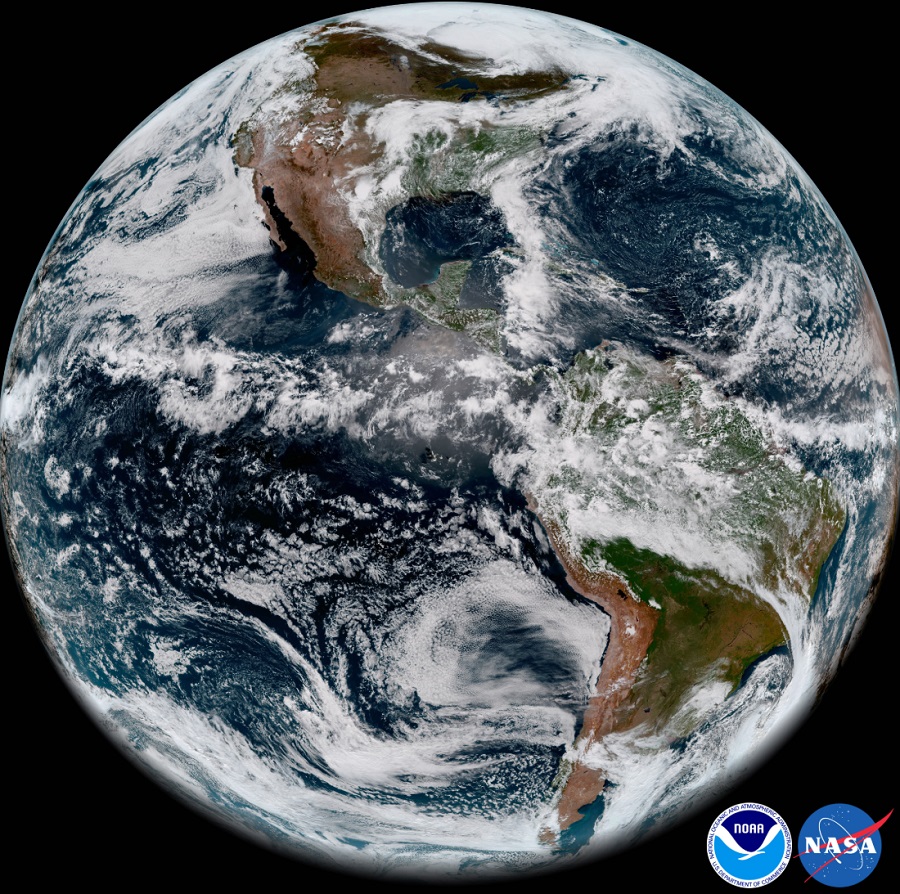
The National Oceanic and Atmospheric Administration released one of the first images snapped by GOES-17, a weather satellite which was launched last fall. The stunning image shown above, or here in it’s original high-resolution 82MB view, is from the Advanced Baseline Imager (ABI) component on the satellite which was named GOES-S for lift-off. Once in Orbit, GOES-S was renamed GOES-17 and has been undergoing testing prior to becoming completely operational. However, during this testing phase, program scientists discovered that a significant malfunction is occurring on-board with its cooling system, preventing much of the expected imagery to be captured for at least half of every day.
Stephen Volz, NOAA’s assistant administrator for satellite and information services, told reporters that the glitch is a “serious problem” during a conference in May. “This is the premier Earth-pointing instrument on the GOES platform, and 16 channels, of which 13 are infrared or near-infrared, are important elements of our observing requirements, and if they are not functioning fully, it is a loss. It is a performance issue we have to address”, said Volz.

The image released is actually a composite of several. This imagery was created using two visible bands (blue and red) and one near-infrared “vegetation” band that are functional with the current cooling system performance. According to NOAA, “When combined as a “GeoColor” image, depicting the Earth in vivid detail and colors intuitive to human vision, these bands provide valuable information for monitoring dust, haze, smoke, clouds, fog, winds and vegetation. ABI imagery also provides information on cloud motion, helping meteorologists monitor and forecast severe weather and hurricanes. The improved resolution and faster scanning ability of the instrument compared to the previous generation of GOES allow forecasters to more rapidly detect and analyze storms as they are developing and intensifying.”
GOES-17 is the second in a series of next-generation geostationary weather satellites. Like GOES-16, its sister satellite operating as GOES East, GOES-17 is designed to provide advanced imagery and atmospheric measurements of Earth from 22,300 miles above the equator.
NOAA’s operational geostationary constellation – GOES-16, operating as GOES-East, GOES-15, operating as GOES-West and GOES-14, operating as the on-orbit spare – is healthy and monitoring weather across the nation each day.
Beyond the geostationary constellation, NOAA also has polar orbiting satellites in its toolbox. Just days ago, one such polar orbiting satellite became operational, adding to the satellites providing meteorologists and their computers with data and imagery around North America.