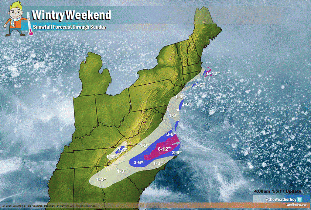
Two weather systems will make for a mess for travelers tomorrow into this weekend, with significant snow expected in areas that don’t often see much snow. Snow will hit in two phases: across the northern Mid Atlantic in places near and to the east of the Philadelphia and New York City metro areas on Friday morning with a second system hitting southeast Virginia, North Carolina, and northern South Carolina later Saturday into early Sunday.
Originally, the thinking was the second system would track just close enough to portions of the Maryland, Delaware, and New Jersey coasts to produce several inches of additional snow beyond Friday’s light snowfall. However, we now believe such a set-up will exist a tad east over the open waters of the Atlantic. As such, snowfall accumulation forecasts for that area have been trimmed back.
Flurries and snow showers are expected in Pennsylvania, West Virginia, and New York state. Accumulating snow will be confined south and east of I-95 in the New York City metro area, New Jersey, and Delaware, where a light 1-3″ may fall from the first system. Some 3-5″ amounts are possible in south coastal New Jersey and eastern Long Island. Snow totals will also dramatically pick up as one heads east in southeastern New England to the Cape Cod area. While we expect just a light dusting in Boston’s southern suburbs, upwards of 6-10″ is possible near the Cape itself.
The main event with this batch of wintry precipitation will be Saturday into Sunday where snow, heavy at times, is expected to fall over portions of southeastern Virginia, northern South Carolina, and a large part of North Carolina. Here, 6-12″ is possible with a broader, plowable 3-6″ likely too around the heavy snow zone.