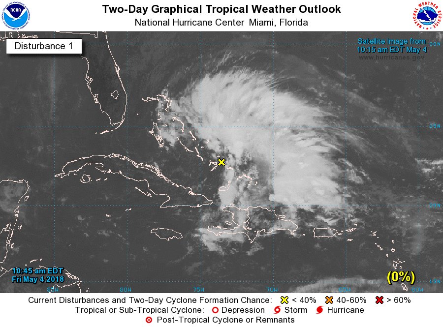
The National Hurricane Center (NHC) has issued a Special Tropical Outlook today for a disturbance located near the Bahamas. While the first day of the 2018 Atlantic Hurricane Season isn’t until June 1, the National Hurricane Center works year-round; sometimes, tropical cyclones do form in the off season.
A large area of showers and thunderstorms near the Bahamas is associated with an upper-level low pressure system and a surface trough. According to the NHC, he system is forecast to move westward over the Florida peninsula on Saturday with no significant development expected. While the storm isn’t expected to take on tropical cyclone characteristics, locally heavy rains and gusty winds are possible over portions of the Bahamas and southern Florida through this weekend.
The National Hurricane Center says no additional Special Outlooks on this system will be issued unless conditions warrant.
The 2018 Atlantic Hurricane Season is forecast to be an active one. Colorado State University’s Tropical Meteorology Project Outlook released in April expects an above normal number of tropical systems this season, which runs June 1 – November 30. (Weatherboy is a sponsor of that research.)
When the first tropical cyclone of the season is named, it will be called Alberto. The full list of names for the 2018 Atlantic season is found here.
