The National Weather Service’s Storm Prediction Center (SPC) is concerned about the potential for a significant severe weather outbreak early next week, taking the unusual step of warning the public of such a possibility 6 days out.
“While specifics will remain uncertain until the event draws closer, the potential for multiple rounds of severe convection including supercells, clusters, and likely an eventual squall line will likely bring a threat for all severe weather hazards including strong tornadoes,” the SPC warns in their latest forecast discussion.
According to the Storm Prediction Center, a compact mid-level low will move east across the Southwest on Sunday which will result in lee cyclogenesis in the southern/central High Plains. As surface high pressure across the Midwest moves east too, a favorable low-level trajectory and strengthening flow across the Gulf of America and the southern Plains will initiate significant moisture return across Texas.
The initial mid-level low will weaken as it moves across the Plains and into the Mid-Mississippi Valley on Monday morning. However, lee cyclogenesis will likely strengthen Monday afternoon as a larger scale trough approaches the southern Plains. Shortwave ridging will likely keep the dryline capped on Monday with continued moistening beneath the capping inversion as low-level moisture advection continues. By Tuesday morning, moisture recovery across the western Gulf of America region should be complete with 70F dewpoints forecast near the Gulf Coast by global forecast models setting the stage for a severe weather outbreak.
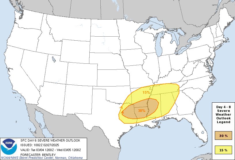
The peak of this severe weather outbreak is likely to occur somewhere near southeastern Texas, northern Louisiana, southern Arkansas, and west-central Mississippi on Tuesday and Tuesday night.
This area of severe weather is forecast to march east Tuesday night into Wednesday, reaching portions of the southern Mid Atlantic and southeast coast for another day of severe weather hazards there.
Severe thunderstorms are storms that meet specific criteria and produces one or more of the following elements: a tornado, and/or damaging winds or speeds of 58 mph or greater, and/or hail 1″ in diameter or larger.
A strong tornado also carries a specific definition; they are typically classified as an EF2 or EF3 on the Enhanced Fujita Scale (EF Scale), meaning it has estimated wind speeds between 111-165 mph and can cause significant damage to structures, including ripping off roofs and uprooting large trees; essentially, a tornado considered “strong” is one that can produce considerable damage to well-built buildings.
