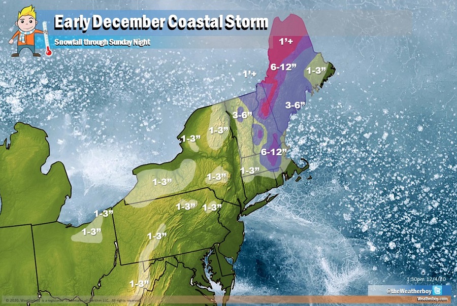
A storm is forecast to bring wind-whipped heavy rain and snow to portions of the northeast this weekend. A storm system tracking across the southeast will rapidly strengthen tonight and Saturday while tracking just off the coast of the Northeast. Heavy snow and strong winds are expected over much of New England from Massachusetts into Maine on Saturday.
Due to the threat of severe wintry weather, the National Weather Service has issued Winter Storm Watches for most of Maine, New Hampshire, Vermont, and interior Massachusetts. The National Weather Service office in Burlington, Vermont has also issued a Winter Storm Warning for Orleans, Caledonia, and Essex Counties. They warn, “if you must travel, keep an extra flashlight, food, and water in your vehicle in case of an emergency.”
The storm is moving somewhat faster and more east than initially expected; as such, the areas expecting the heaviest snow will also slide east.
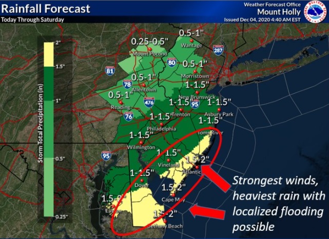
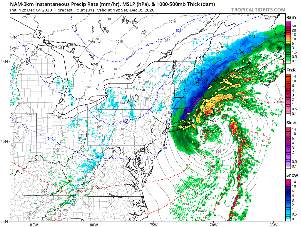
Most precipitation from the New York City area and points south and east will remain plain rain. Some of that rain could be heavy at times, creating some isolated flooding issues.
In addition to soaking rains, winds will be strong and gusty. Some of those strong winds will come in the heavier bands of rain that’ll impact portions of southern New Jersey, Delaware, and eastern Maryland.
There is a slight chance of coastal flooding from this storm. Because it is moving so fast, the impacts from coastal flooding should be minimal and not long lasting.
As colder air wraps around the exiting storm system on Sunday on blustery northwest winds, untreated wet surfaces may freeze before they dry. As such, people should exercise caution and watch-out for icy patches, even in areas that only get plain rain from the storm.
