• Skip to primary navigation
  • Skip to main content
  • Skip to primary sidebar

Weatherboy

Weatherboy Weather News, Maps, RADAR, Satellite, and Forecasts.

  • Local
  • Earth Science News
  • RADAR
  • Current Warnings
  • Satellite
  • Current Maps
  • Forecast Maps
  • Video

Strong Low Pressure to Impact Mid Atlantic Next Week

by Weatherboy Team Meteorologist - April 21, 2018

A simulated, color enhanced satellite view based on American (GFS) model data, shows an area of low pressure with high cloud tops off the Jersey Shore by late Tuesday. Image: tropicaltidbits.com


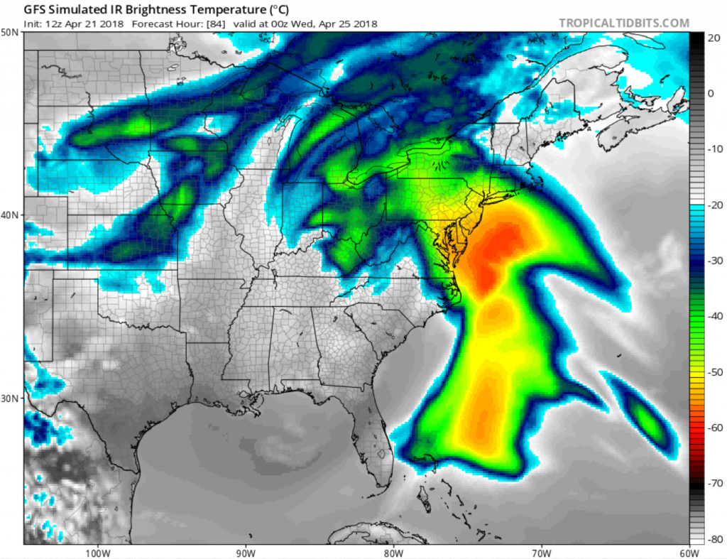
In keeping the theme of a prolonged, cool and wet spring, another strong low pressure system will impact the eastern US in the coming days. High pressure will keep conditions dry but cool across the northeast this weekend. This high is forecast to off-shore by Monday, allowing the low level flow to become onshore, resulting in increasing moisture advection ahead of the next storm system. That next storm system, currently located over Texas, will very slowly progress east and then northeast, reaching the Mid Atlantic by mid week. The main period of
rain with this system looks to be Tuesday into Wednesday, coincident with stronger lift associated with the warm front tied to this system.

With mild temperatures expected well north into Canada, only rain is expected from this storm system.

Due to the slow movement of the low pressure system and its related low level on-shore flow, there is some concern of heavy rain, primarily late Tuesday night into Wednesday morning. Winds and coastal flooding may also become a concern as this system slowly makes it way through the region. Should the probability of these types of weather threats increase, the National Weather Service could issue advisories in the coming day ahead of this storm.


Once that low lifts northeast away from our region by Thursday, conditions will become temporarily dry due to weak high pressure. However, more unsettled weather is likely to return with yet another northern stream system forecast to impact the region at the end of the week or early part of next weekend.

Primary Sidebar

Sponsored Ad

Search

Latest News

  • Tornado Watches, Warnings Issued as Severe Weather Impacts Louisiana, Mississippi, Alabama, & Gerogia
  • After Violent Night, Storms Shift to Ohio and Pennsylvania
  • Preliminary NTSB Report Shows Something other than Turbulence Killed Passenger on New England Flight
  • SEVERE Geomagnetic Storm Alert Issued; Massive Aurora On Display in North America
  • World’s Largest Volcano Quakes; No Tsunami Threat Around Hawaii
  • Impacts from Geomagnetic Storm Expected Thursday through Saturday; Watch Issued
  • Three Quakes Rattle Mid Atlantic Ridge; No East Coast Tsunami Threat
  • Spring 2023 Arrives Today
About | Careers | Contact | Contests
Terms | Privacy | Ad Choices
Weatherboy is a (R) Registered Trademark of isarithm LLC, All Rights Reserved.
All content herein is Copyright by Isarithm LLC 1997-2022