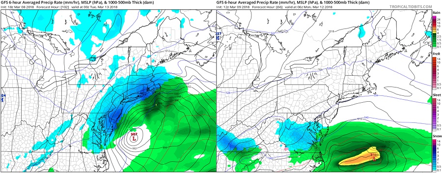
Forecast models remain a bit conflicted in how the next coastal storm will evolve, although meteorologists do believe they have a better handle on these two storm scenarios. Forecast models are computer-generated simulations that show how conditions in all layers of the atmosphere can evolve over-time, powered by super computers that crunch millions of data points. These sophisticated machines often arm meteorologists with great insights in how storms will form and evolve; however, they are not flawless and can lead those that follow them exclusively down the wrong path. The two best known global forecast models are the American GFS model and the European ECMWF model. While there are many other global and regional forecast models, the GFS and ECMWF typically have the greatest weight among the tools meteorologists use to forecast the weather.
The models continue to show development of low pressure across the southeastern part of the country and then push that to the northeast. Unfortunately for meteorologists and the public that depend on them, the models are still all over the place with regards to what will eventually happen. It all stems from different timing of individual short waves and how they phase across the eastern US early next week. Overnight and afternoon solutions show a variety of potential paths and outcomes; some show an out-to-sea solution with limited precipitation in the southern and central Mid Atlantic. Others show slow development, which would produce only light precipitation in the Mid Atlantic. Others show a deeper low pressure system: one has it well off-shore, which would produce minimal, if any, impacts to the Mid Atlantic and the Northeast while another shows a significant coastal storm, which would bring wind-whipped rains to the coast and heavy wet snow inland. In the latest forecast discussion from the Mount Holly, New Jersey National Weather Service office, meteorologists there say, “No real confidence in any solution at this point.”
However, when examining climatology and the weather pattern that exists right now over the northeast and northern Atlantic Ocean, one storm solution can be favored: the one that takes the system out to sea. With a progressive flow beginning to build and an atmospheric block breaking down over the northwestern Atlantic Ocean, it is becoming more likely at this time that the storm will head more out to sea than ride up the northeast coast. While confidence is marginal, it is improving with such an out-to-sea forecast. Such a forecast would be a tremendous sigh of relief to millions still dealing with the damage from the last two coastal storms to impact the northeast with coastal flooding, heavy wet snow, and wind damage.
As more atmospheric data is sampled this evening, confidence will increase greatly in the forecast outlook. It is also likely that the flip-flopping of the models will stop as they converge onto a similar solution by Saturday morning ahead of possible late Sunday/early Monday impacts this storm may produce.