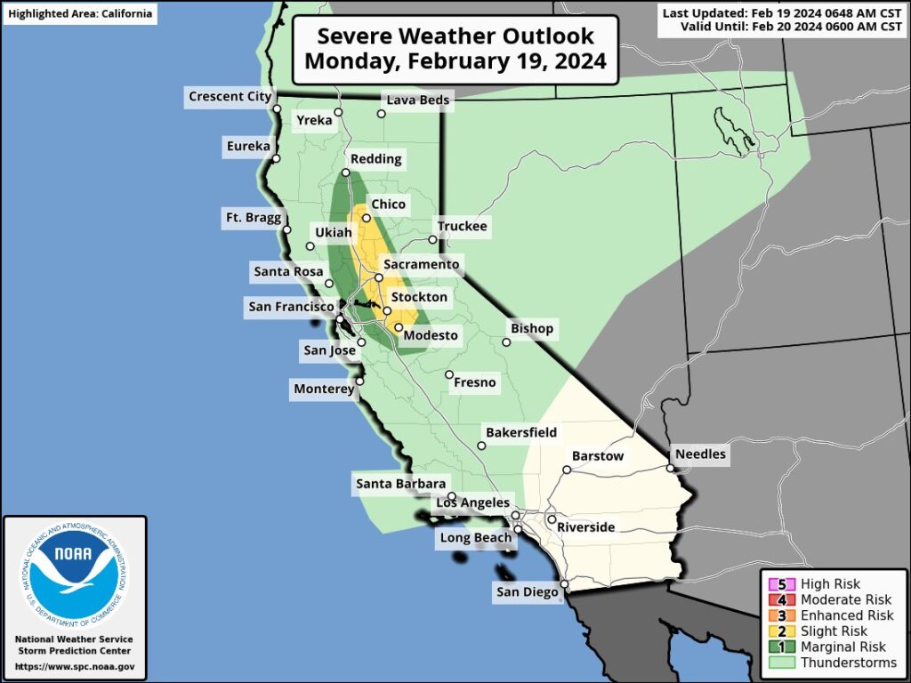
There’s a threat of severe thunderstorm and isolated tornadoes in northern California today; there’s also a threat of severe turbulence over Californian airspace, with the greatest threat east of the San Francisco Bay area. Another in a series of atmospheric river events is to blame for today’s severe weather conditions.
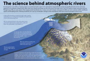
The atmospheric river event will bring heavy coastal and low elevation rain, thunderstorms, heavy mountain snow, and high winds to much of California. Scattered thunderstorms may produce a tornado or two in the Sacramento Valley region. The National Weather Service’s Storm Prediction Center has identified this area with an elevated threat of tornadoes today; while not everyone will see a tornado, the odds of one or two touching down are climatologically significant today.
The core of an energetic large-scale low pressure system will continue to push onshore today. Under this weather pattern, California remains under the impact of heavy precipitation. The northern portion of California will be one area of concern where additional heavy rainfall will lead to a slight risk of flash flooding into Tuesday. Another area of concern will be along portions of coastal southern California where more focused heavy rainfall forced by local terrain will keep a moderate risk of flash flooding in place through tonight. Meanwhile, heavy snow can be expected over the higher elevations.
By Tuesday, the low pressure system is forecast to weaken. This will allow the coverage and intensity of the rain/snow to progressively decrease with time. Nevertheless, additional residual energy arriving from the Pacific will result in more rounds of light to moderate elevation-dependent rain/snow into Wednesday. Meanwhile, moisture from the weakening low pressure system will continue to push well
into the Intermountain West, bringing additional rounds of rain/snow across the Great Basin and into the northern Rockies over the next couple of days before reaching into the central Rockies and toward the Four Corners by Wednesday.
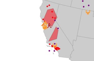
In addition to severe conditions on the ground today, the National Weather Service’s Aviation Weather Center is also warning of severe conditions in the air. SIGMETs are being issued to alert flight crews of hazardous conditions in the air which could lead to severe turbulence.
For U.S. Airspace, the National Weather Service’s Aviation Weather Center (AWC) monitors aviation weather and will issue alerts when severe weather or harsh flying conditions are present. Known as a SIGMET, short for Significant Meteorological Information, the severe weather advisory issued by the AWC contains weather-related information concerning the safety of all aircraft passing through a specific zone. Sometimes AIRMETs are issued too; an AIRMET consists of turbulence, visibility, and icing-related warnings that are less severe than those in a SIGMET.
