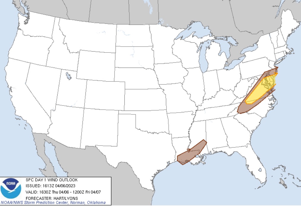
In the latest update from the National Weather Service’s Storm Prediction Center (SPC), today’s severe weather threat zone has been refined to focus on extreme southern New Jersey, the southern half of Delaware, portions of eastern Maryland, and portions of central and eastern Virginia. Unlike Saturday’s severe weather outbreak in the Mid Atlantic which was responsible for an impressive tornado outbreak across portions of New Jersey, Pennsylvania, and Delaware, the primary threat with today’s severe weather is damaging wind gusts; some large hail is also possible. While a severe thunderstorm could always produce an isolated tornado, the odds of tornadic formation today remains very low.
According to the SPC, the latest surface analysis shows a cold front sagging southward across Pennsylvania and West Virginia. This boundary will move into a warm and moist air mass this afternoon over the Mid Atlantic region, where dewpoints the 60s and strong heating is present. A consensus of model guidance shows scattered thunderstorms developing along and ahead of the cold front. This
area lies along the southern fringe of stronger westerlies aloft, and in corridor of forecast afternoon atmospheric instability. With that said, parameters are sufficient to promote a risk of severe storms
capable of damaging winds and hail. Storms should be most active in the 4pm – 9pm window.
The updated analysis from the SPC shifts today’s severe weather threat a bit further south than initially forecast yesterday.
Not every town within the area defined by the SPC with an elevated threat will see strong to severe storms, but thunderstorms that do form in these areas could become severe. If the National Weather Service local offices see a severe thunderstorm or even a tornado moving through, they will issue a Severe Thunderstorm Warning or Tornado Warning for potentially impacted counties quickly.
