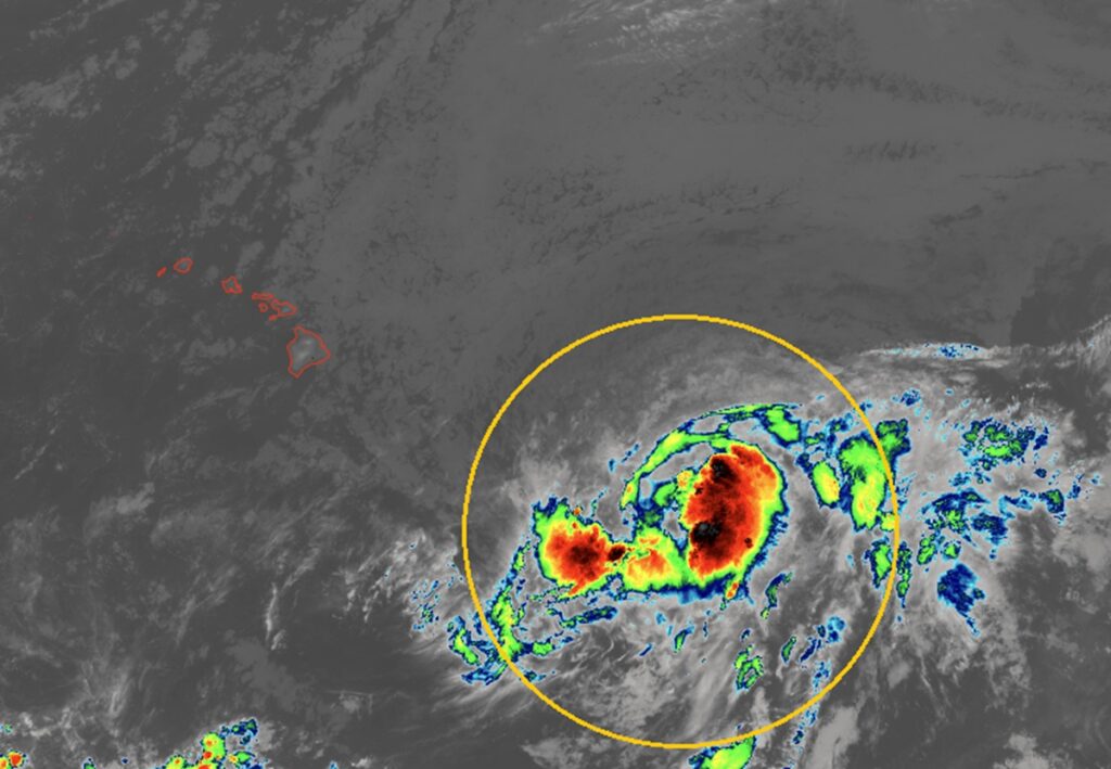
The Central Pacific Hurricane Center (CPHC) in Honolulu, Oahu, Hawaii and the National Hurricane Center (NHC) in Miami, Florida have upgraded a disturbance being tracked to the south and east of the Aloha State to Tropical Storm Lala, the first named storm of the Central Pacific Hurricane Season; with it on track to approach the islands this weekend, they’ve also issued a Hurricane Watch for the Big Island of Hawaii. Additional watches or warnings could be issued for Hawaii Island and the other islands in the state in the coming hours and days.
According to the CPHC, over the past several hours, deep convection has been increasing near the center and in bands on the north side of the system. In addition, the circulation appears less elongated and more consolidated. Based on the improvement in its appearance, the system meets the criteria of a tropical storm.
An Air Force reconnaissance aircraft is scheduled to investigate Lala later this morning, and the NHC says that data captured on that aircraft will be quite helpful in better assessing the storm’s intensity, structure, and future track.
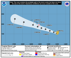
In the latest advisory issued by the CPHC, Lala was located at 15.2 N 145.5 W or roughly 705 miles east-southeast of Hilo on the Big Island of Hawaii and 915 miles east-southeast of Honolulu on the island of Oahu. Maximum sustained winds are up to 40 mph while minimum central pressure is down to 1001 mb or 29.56″.
The CPHC says Lala will travel in a westward to west-northwestward motion during the next several days. On the forecast track, Lala is expected to be near or just south of the Big Island on Saturday, and pass south of the smaller islands during the remainder of the weekend. As it heads towards Hawaii, steady strengthening is forecast, and Lala could be near hurricane strength as it approaches the Big Island.
With Lala expected to bring impacts to Hawaii Island, a Hurricane Watch has been issued there. A Hurricane Watch means that hurricane conditions are possible within the watch area. A watch is typically issued 48 hours before the anticipated first occurrence of tropical-storm-force winds, conditions that make outside preparations difficult or dangerous.
It is expected that the Big Island will be impacted by strong, potentially damaging winds, very heavy rainfall, large and dangerous waves, and the risk of storm surge flooding at the coast.
Winds are expected to be the strongest downslope of higher terrain, over headlands, and through passes such as the DKI Highway / Saddle Road on the Big Island. The possibility of hurricane force wind gusts exist over the entire Big Island. Wind speeds atop and on the windward sides of hills and mountains are often up to 30 percent stronger than the near-surface winds indicated in this advisory, and in some elevated locations could be even greater. Ahead of Lala’s arrival, strong winds and dry weather conditions could create worsening fire weather conditions. Wildfires are currently burning in western Hawaii and increasing winds ahead of the storm may help fan those flames.
Heavy rainfall associated with Tropical Storm Lala will begin to impact the Big Island Friday, spreading westward across the island chain during the weekend. Tropical Storm Lala is expected to produce rainfall totals of 5-10″ across much of the Island chain, with maximum totals of 20″ possible. This rainfall may produce life-threatening flooding and mudslides, especially in areas of steep terrain. On the Big Island, the heaviest rain will impact the southern and eastern sides of the island while the least rain is expected in North and South Kohala on the island’s northwest side.
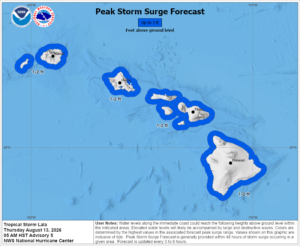
Large and dangerous waves, especially on the Big Island, are expected this weekend, with the greatest impacts along the southern shores. This prolonged period of heavy surf may cause localized coastal flooding and significant beach erosion.
The combination of a dangerous storm surge and the tide will cause normally dry areas near the coast to be flooded by rising waters moving inland from the shoreline. The water could reach 1-3 feet above ground around the Big Island if the peak surge occurs at the time of high tide. The deepest water will occur along the immediate coast, where the surge will be accompanied by large and dangerous waves. Surge-related flooding depends on the relative timing of the surge and the tidal cycle, and can vary greatly over short distances.
There is also a risk of isolated tornadoes, especially on the Big Island. The National Weather Service in Honolulu says there’s the potential for a few tornadoes and they encourage people around Hawaii to plan, prepare, and potentially act due to this threat.
“PLAN: Emergency plans should include the potential for a few tornadoes,” says the National Weather Service, adding, ” PREPARE: If your shelter is particularly vulnerable to tornadoes, prepare to relocate to safe shelter before hazardous weather arrives. ACT: If a tornado warning is issued, be ready to shelter quickly.”
The National Weather Service is also urging everyone on the Big Island to take action now to protect life and property ahead of Lala’s impacts. “Efforts to protect life and property should now be underway. Prepare for significant wind damage….Act now to complete preparations before the wind becomes hazardous,” said the National Weather Service in one of their latest bulletins. .
