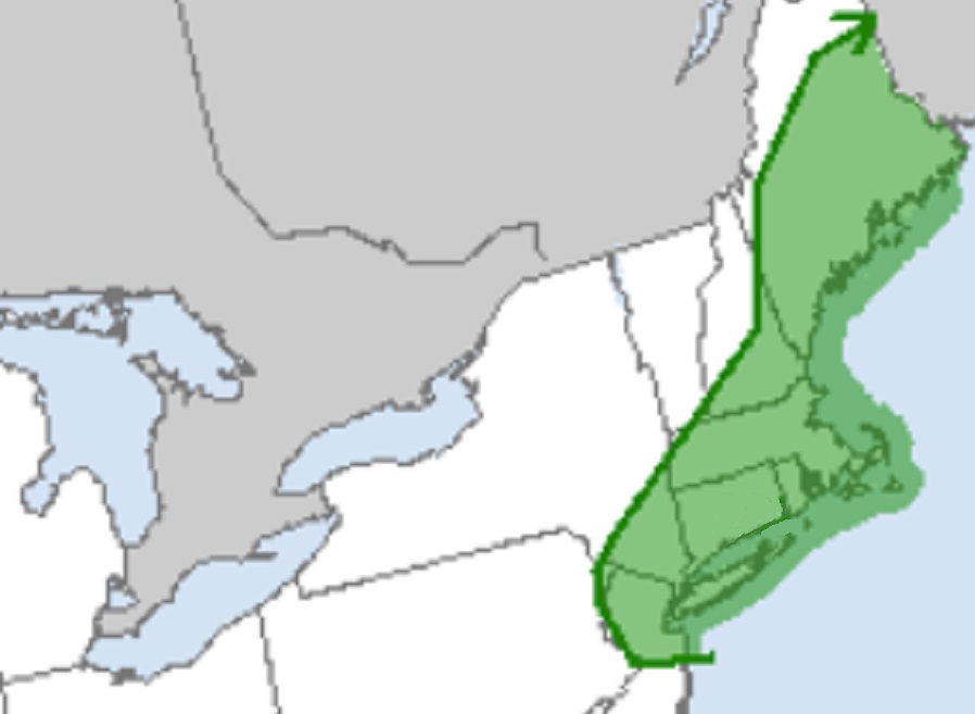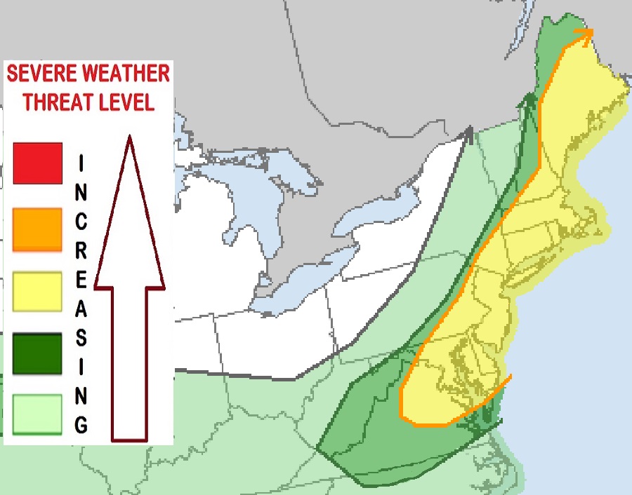
Another severe weather event is forecast to unfold again across portions of the northeast, with an area encompassing New Jersey to Maine under threat for isolated tornadoes and damaging wind gusts as thunderstorms develop today. Severe storms are also possible across a broader area encompassing most of the I-95 corridor from central Virginia north to New England today.
Scattered thunderstorms are expected to form through this afternoon along and ahead of the surface cold front, near a prefrontal surface trough, across the northeast today. According to the National Weather Service’s Storm Prediction Center (SPC), an existing plume of clouds and precipitation with widely scattered embedded thunderstorms located over northern Maine into Pennsylvania this morning should continue to break up gradually on the north end , allowing for some destabilization in its wake, but also setting up localized to mesobeta-scale areas of differential heating that may aid storm initiation from midday into the afternoon as well.
The SPC says that scattered damaging gusts, and several severe 57 mph+ gusts, are possible as thunderstorm activity fires-up during the midday hours. An elevated tornado threat also exists over parts of the northeast, where low-level and deep shear will be the greatest under relatively maximized flow aloft. This elevated tornadic risk zone is over central and northern New Jersey, the entire metro New York City area, all of Long Island, much of southeastern Upstate New York, all of Connecticut, Rhode Island, and Massachusetts, southeastern New Hampshire, and all but far northern and western Maine. While not everyone will see a tornado in this region, let alone a severe thunderstorm, people should be prepared to take immediate action to get to a place of safe shelter should severe weather strike their community.

Beyond the area where tornadic cells are possible, there’s a broader area where damaging wind gusts are possible. In addition to the tornado risk zone, southeastern Pennsylvania, all of New Jersey and Delaware, most of Maryland, and parts of central and northeastern Virginia are at risk of damaging wind gusts today in tornadoes. Unlike the rapidly rotating column of winds found in a tornado, severe straight-line winds are possible in this region as thunderstorms move from west to east.
The most severe weather will happen around the I-95 corridor roughly between 3pm and 6pm while storms will arrive a few hours earlier north and west of there and a few hours later south and east of there. Most storms should clear the coast by 9pm in the Mid Atlantic and 11pm in New England.