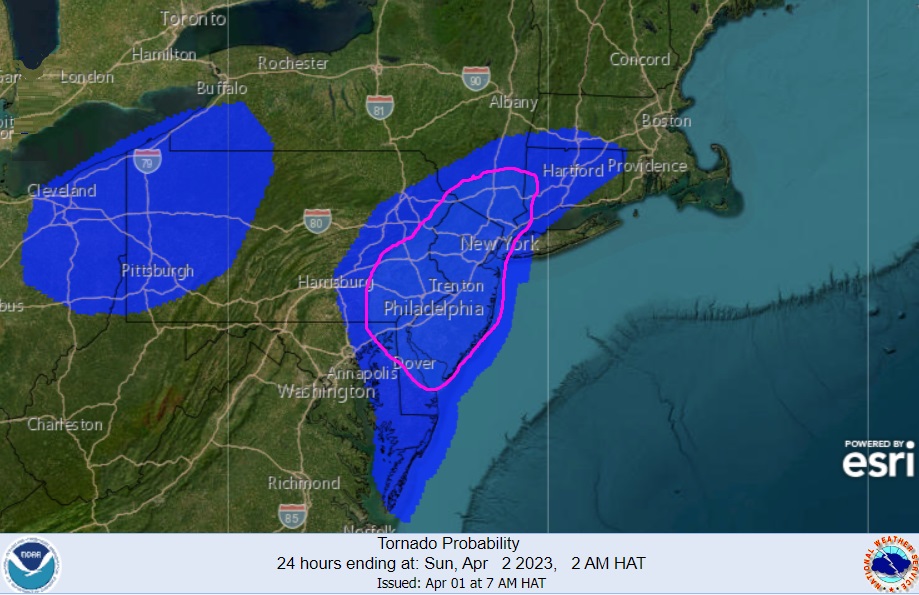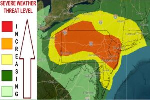
A tornado threat continues to grow in New Jersey, Pennsylvania, and Delaware as the death and injury toll from yesterday’s severe weather outbreak continue to mount. According to the National Weather Service’s Storm Prediction Center (SPC), the greatest threat of tornadic cells today anywhere in the country is over all of New Jersey, eastern Pennsylvania, far northeastern Maryland, much of the northern half of Delaware, southeastern New York including New York City, and southwestern Connecticut. There’s also a risk of tornadoes across western Pennsylvania, eastern Ohio, and far southwestern Upstate New York.

Beyond the tornado threat, severe thunderstorms are likely across much of Pennsylvania and New Jersey where there’s also the chance of large, damaging hail and strong, destructive straight-line wind gusts.
“Damaging winds and a couple tornadoes will be possible across parts of the Northeast this afternoon and evening,” warns the SPC. “Isolated to scattered damaging winds and a tornado or two remain possible across parts of the Southeast through the afternoon.
While pervasive cloud cover persisted at midday, the SPC expects steady clearing this afternoon based on radar and satellite trends. The environment will support both a conditional supercell environment as well as persistence/potential rejuvenation of the upstream fast-moving convective line. The SPC says that if a few supercells materialize, tornadoes, hail, and damaging winds would all be possible, and damaging winds are otherwise probable with the inbound convective line roughly centered
in the 4pm- 9pm time frame for eastern Pennsylvania, New Jersey, and southern New York/NYC Metro vicinity where the most severe conditions are possible.
Today’s severe weather is from the same weather system responsible for a lethal assault of tornadoes and severe storms on portions of the Mississippi, Tennessee, and Ohio Valleys yesterday and last night. There have been more than 50 preliminary tornado reports recorded by the SPC yesterday. The death toll from Friday’s storm is up to 17, with more than 500 people injured. Thousands of people remain in the dark with storms destroying electrical lines and poles.
Tornadoes are violently rotating columns of air that extend from a thunderstorm to the ground. Tornadoes can destroy buildings, flip cars, and create deadly flying debris.
If a Tornado Warning is issued for your county, follow the instructions of state and local officials. Go to a safe shelter immediately, such as a safe room, basement, storm cellar, or small interior room on the lowest level of a sturdy building. Stay away from windows, doors, and outside walls. Do not open windows. If you’re on the road, do not go under an overpass or bridge; you are safer in a low, flat location. Watch out for flying debris that can cause injury or death. Use your arms to protect your head and neck. Do not try to outrun a tornado if you’re in a vehicle. If you are in a car or outdoors and cannot get to a building, cover your head and neck with your arms and cover your body with a coat or blanket, if possible. You may only have seconds or minutes to react in the time between a Tornado Warning is issued and when the tornado impacts your area.