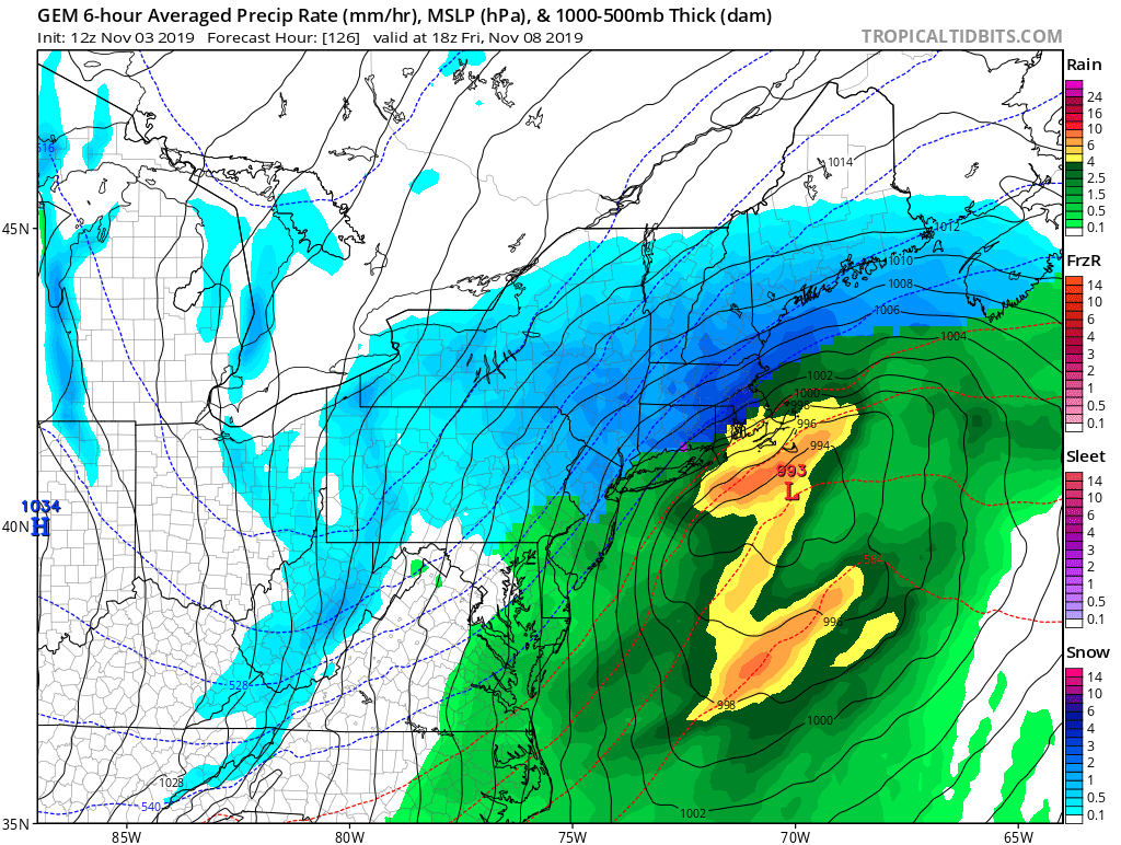
Computer forecast models that meteorologists use to help with their weather forecast work are suggesting that an early season winter storm could form in portions of the Mid Atlantic or Northeast by the end of the week, producing the first few inches of snow for what will likely be an interesting winter snow season.
The global forecast model from Europe, the ECMWF, was the first to indicate the possibility of snow for portions of the Mid Atlantic. It continues to suggest the chance for a light accumulation of snow across portions of Virginia, Maryland, Delaware, Pennsylvania, and New Jersey which would fall on Friday.
Like the European forecast model, the American GFS model also shows a storm forming in the southeastern U.S. into the Mid Atlantic but has it exiting quickly off the coast. If this scenario were to unfold, light snow could fall across portions of the eastern Mountains of Tennessee and Kentucky, the higher elevations of western North Carolina, southern West Virginia, and portions of Virginia. Such snow would fall on Friday.
The GEM Canadian forecast model depicts a more amplified system that would track closer up the New England coast. Such a scenario would bring more precipitation to the northern Mid Atlantic and New England. It would also bring up some milder air with it, so portions of southern New Jersey and southeastern Pennsylvania and points south would only see rain while snow would fall north and west from there. While the American and European forecast models suggest light amounts at most, the Canadian solution would put down significantly more –on the order of 6-12″– where more heavy snow could fall.
It is still too early to say with certainty how this storm will evolve. How much it intensifies and amplifies and how close it gets to the coast will be better known within the next 36 hours as more data is sampled around the country ahead of this storm formation. For now, residents should be aware there’s a chance of winter weather in the Eastern U.S. at the end of the work week, although meteorologists have low confidence in any one solution at this time.