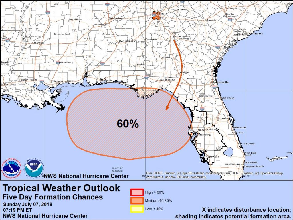
The National Hurricane Center (NHC) has been monitoring an area of potential development in the southeastern United States for some time now; now they believe it is likely a tropical cyclone will form.
While most tropical cyclones have origins over open water, they can also occasionally be triggered by weather systems moving across the land. That is the case with this system that first popped up over Tennessee and is now over Georgia. This trough of low pressure located over the southeastern United States is forecast to move southward toward the northeastern Gulf of Mexico, where a broad area of low pressure will likely form in a few days. According to the NHC, some gradual development is possible thereafter and a tropical depression could form by the end of the week while the low meanders near the northern Gulf Coast.
Even if the system doesn’t develop into a tropical cyclone, extremely heavy rainfall is possible along portions of the central and eastern U.S. Golf Coast later this week. Depending on how strong this disturbance becomes and where it travels, heavy rain could move up the east coast too from the weekend beyond.
Residents along the U.S. Gulf and East Coasts are urged to have their Hurricane Action Plans in order before any threat materializes.