It appears a tropical cyclone is forming along the Mid Atlantic Coast and the National Hurricane Center says it is likely it’ll be upgraded to a tropical depression or a named Tropical Storm by the end of the day.
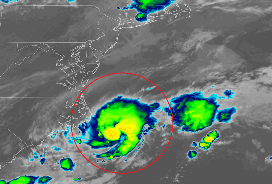
According to the latest Tropical Outlook issued by the National Hurricane Center (NHC) in Miami, Florida minutes ago, satellite, radar and surface observations indicate that a well-defined low pressure system located about 90 miles southeast of Cape Hatteras, North Carolina, is acquiring more tropical characteristics. According to the NHC, environmental conditions appear conducive for further development, and a tropical depression or tropical storm is likely to form later today or tonight. If the storm becomes a tropical storm, it would be named Bill. Right now, the NHC says there is a 70% chance of tropical cyclone formation here.
While the system may generate rough surf along the Mid Atlantic and Northeast coast, it should move far enough off-shore to not bring any rain nor wind to the coast. The NHC says it expects the system to
move northeastward away from the United States and move over colder waters south of Nova Scotia on Wednesday, ending any opportunity for further development by midweek.
