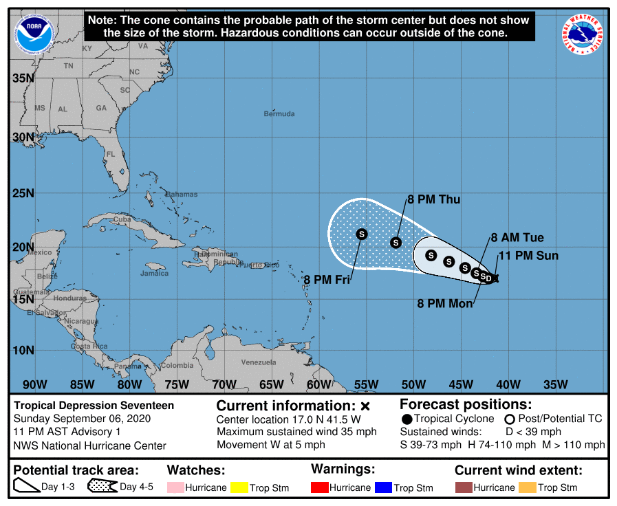
The seventeenth tropical depression of an exceptionally busy Atlantic hurricane season has formed and meteorologists at the National Hurricane Center (NHC) in Miami, Florida expect it to become Tropical Storm Paulette on Labor Day.
As of the latest advisory from the NHC, the new depression was located about 1,160 miles west of the Cabo Verde Islands and about 1,425 miles east of the Northern Leeward Islands. With an estimated minimum central pressure of 1006 mb or 29.71 inches. Maximum sustained winds are up to 35 mph.
Because the storm system is in the middle of the Atlantic far from land for now, there are no coastal watches or warnings in effect.
According to the NHC, the depression is moving toward the west near 5 mph and this motion is forecast to continue into Monday. By late Monday and Tuesday, a turn toward the west-northwest is expected, and that motion should continue into Wednesday. As the system churns about, it is expected to slowly strengthen becoming a tropical storm by tonight. When this system becomes a tropical storm, it’ll be named Paulette.
If Paulette forms as expected, it’ll shatter records for the earliest “P” storm on record in the basin. Currently, the earliest “P” storm on record was 2005’s Philippe which formed on September 17 of that year.