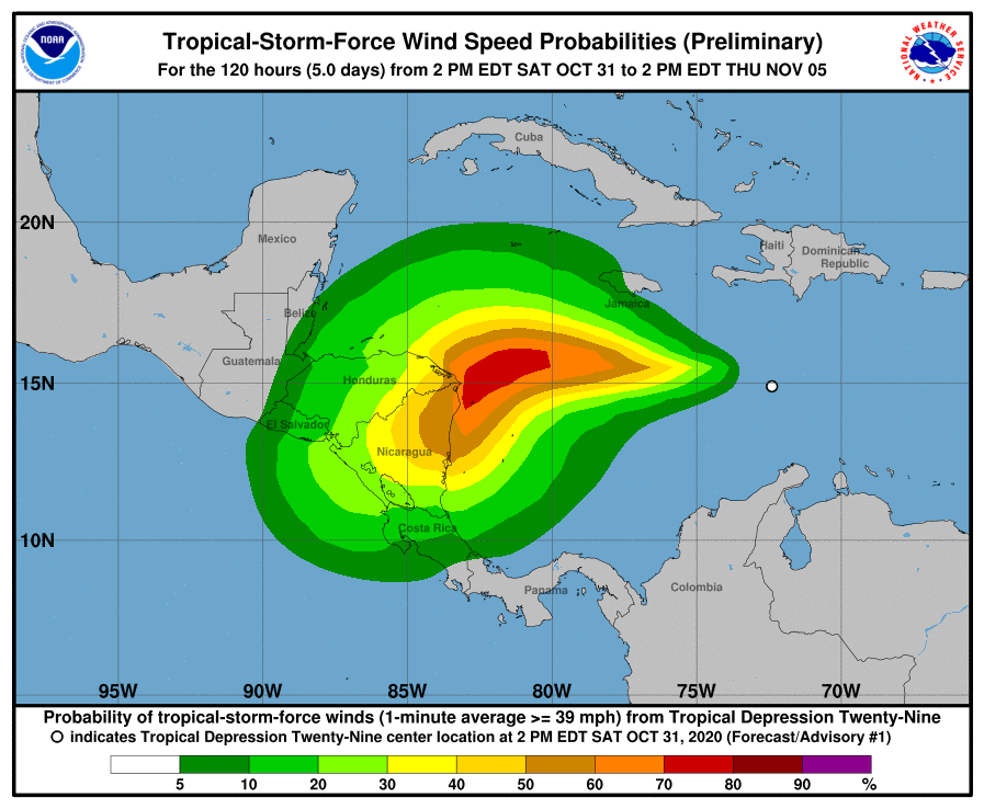
Tropical Depression #29 has formed in the Atlantic Hurricane Basin. Located near 15 N 73.2W, the center of this new system was located about 315 miles southeast of Kingston, Jamaica and roughly 665 miles east of Cabo Gracias on the Nicaragua/Honduras border. With maximum sustained winds of 35 mph, the storm is moving to the west at about 15 mph. The minimum central pressure is at 1006 mb or 29.71″.
The depression is moving toward the west near 15 mph and this westward motion is expected to continue through tomorrow night. A slower motion toward the west-southwest and then southwest is forecast on Monday and Tuesday. According to the National Hurricane Center (NHC), the center of the cyclone is expected to be near the northeastern coast of Nicaragua by Monday night. .
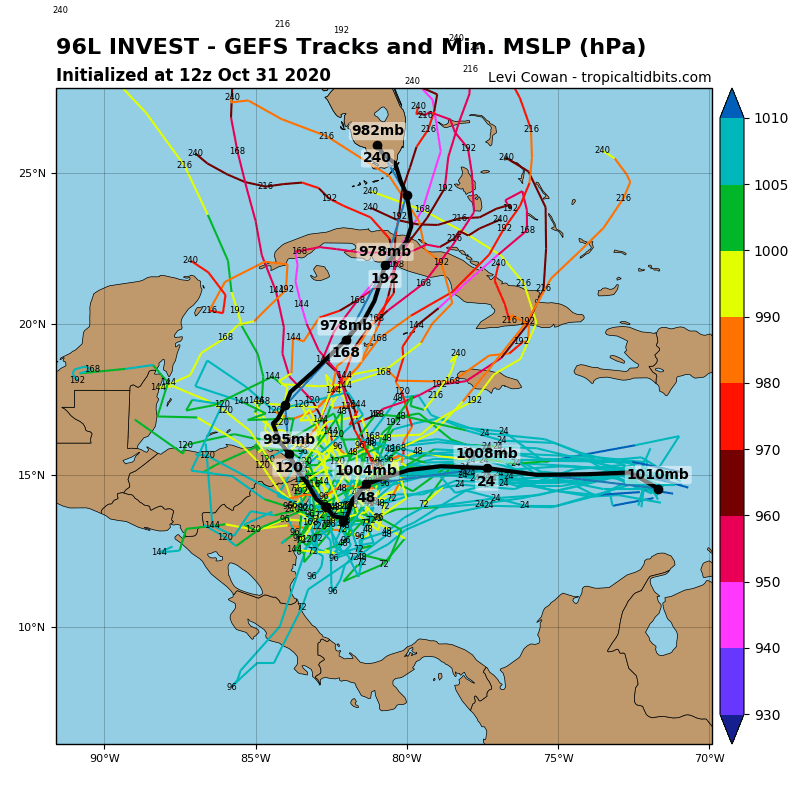
The National Hurricane Center says Tropical Depression #29 is forecast to become a tropical storm tonight and a hurricane by Monday. When it becomes a tropical storm, it would be named after “Eta” in the Greek Alphabet. Never before has there been an Eta in the Atlantic.
Where the storm travels once it becomes a hurricane is up for debate. The European ECMWF computer forecast model suggests a faster westward motion into Central America while the American GFS computer forecast model stalls the system over the western Caribbean and moves it north towards Florida over time. The National Hurricane Center warns they have low confidence in their forecast beyond 48 hours. “This forecast is of generally low confidence…and significant changes could be required in later advisory packages depending on model trends, ” the National Hurricane Center said in a Tropical Depression forecast discussion.
Hurricane season ends on November 30 in the Atlantic. To date, 2020 has produced 27 named storms, 1 shy of tying record-breaking 2005 which had 28 nameable storms. In the post-season analysis, the National Hurricane Center identified an additional subtropical storm that formed near the Canary Islands in 2005. Had that storm been named, there would have been an Eta at the end of 2005 too.
