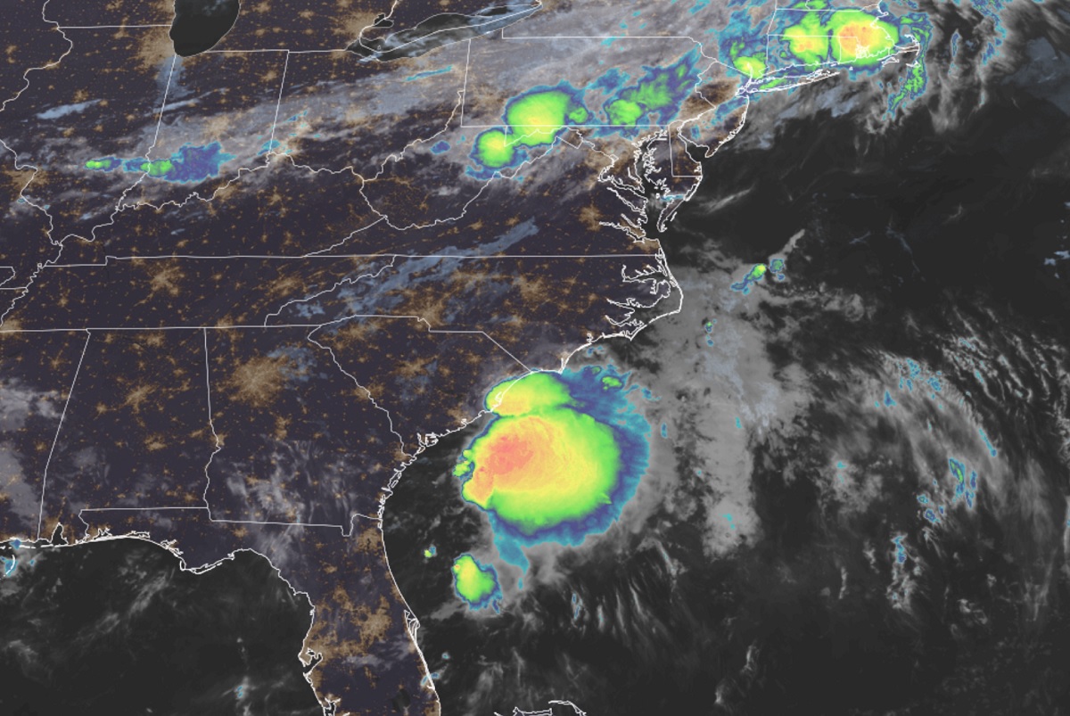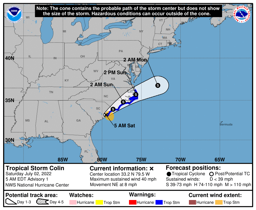
Tropical Storm Colin has formed along the South Carolina coast, making it the third named storm of the 2022 Atlantic Hurricane Season which started on June 1. The National Hurricane Center has issued a Tropical Storm Warning from South Santee River, South Carolina, to Duck, North Carolina, including Pamlico Sound. A Tropical Storm Warning means that tropical storm conditions are expected somewhere within the warning area within 36 hours.
In the first advisory issued by the National Hurricane Center (NHC) at 5 am, the center of Tropical Storm Colin was located just inland over South Carolina near latitude 33.2 North, longitude 79.5 West, which is roughly 50 miles southwest of Myrtle Beach . Colin is moving toward the northeast near 8 mph and this general motion is expected to continue through Sunday.
According to the latest forecast track from the NHC, Colin is expected to turn toward the east-northeast with an increase in forward speed by late Sunday and Sunday night. On the forecast track, the center of Colin is expected to move northeastward along or just inland of the South Carolina and North Carolina coasts through Sunday, and then emerge over the western Atlantic Ocean late Sunday.
At this time, maximum sustained winds are near 40 mph with higher gusts. The NHC says little change in strength is forecast during the next couple of days; by Monday, it’s even expected to dissipate over the western Atlantic well east of Delaware. Tropical-storm-force winds extend outward up to 70 miles, mainly to the southeast of the center. The estimated minimum central pressure is 1011 mb or 29.86″.

A variety of hazards will lash the coast this weekend. Tropical storm force wind conditions are expected within the warning area in South Carolina this morning and will spread northward to the warning area in North Carolina this afternoon through Sunday. Colin will continue to produce locally heavy rainfall across portions of coastal South and North Carolina through Sunday morning. An additional 1-2″ of rainfall, with isolated amounts up to 4″ is expected. This rainfall could result in localized areas of flash flooding. The National Weather Service warns: “Turn around, don’t drown; never drive through flood waters.”
The name Colin has been used for an Atlantic tropical storm before. In 2016, Colin developed from a low pressure area over the Gulf of Mexico near the northern coast of the Yucatán Peninsula on June 5. Moving northward, the depression strengthened into a tropical storm about eight hours after its formation. On June 6, Colin curved to the north-northeast and intensified slightly to winds of 50 mph; fortunately, it never gained more strength than that. On early June 7, Colin eventually made landfall on rural Taylor County, Florida. From there, the system rapidly crossed northern Florida and entered the Atlantic soon after. Later that same day, Colin transitioned into an extratropical cyclone off the North Carolina and was eventually absorbed by a frontal system moving through the region.