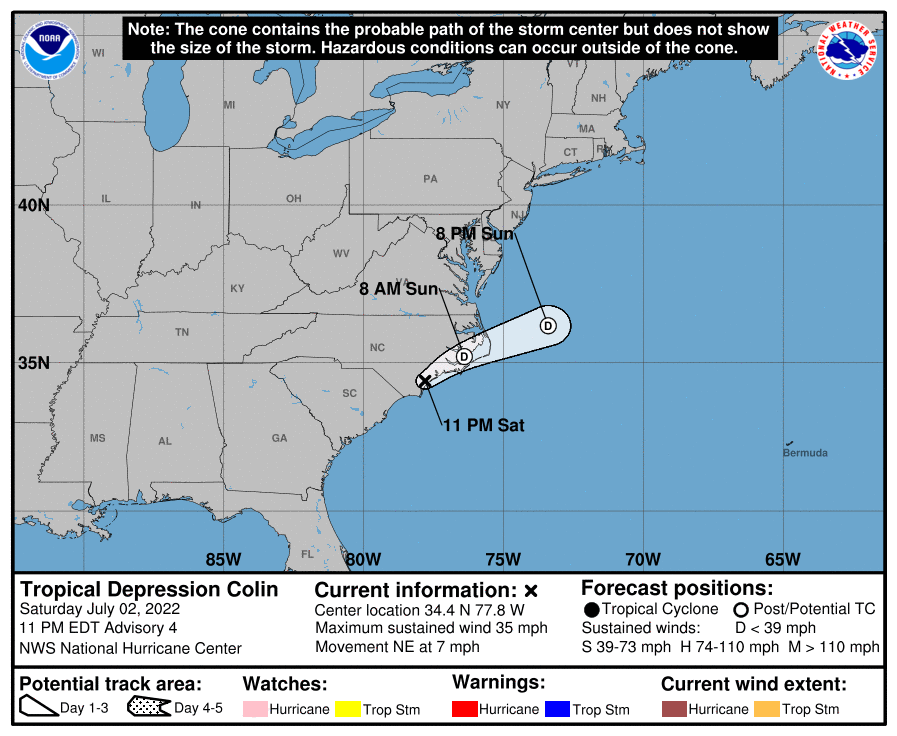
Tropical Storm Colin has weakened to a Tropical Depression; as a result, the National Hurricane Center has dropped all Tropical Storm Warnings that were in effect along the U.S. East Coast. The storm is located near 34.4 North, 77.8 West, which is roughly 15 miles north of Wilmington, North Carolina.
As of the 11 pm advisory from the National Hurricane Center (NHC), Colin had maximum sustained winds of 35 mph and was moving to the northeast at 7 mph. The minimum central pressure of the storm was 1014 MB or 29.95″.
The NHC expects the storm to move a bit faster to the northeast or east-northeast over the next day. On the official storm track released by the NHC, Colin is expected to move northeast along or just inland of the North Carolina coast through Sunday afternoon. Additional weakening is likely, and Colin is expected to degenerate to a remnant area of low pressure later tonight or on Sunday. The system is expected to dissipate completely Sunday night or Monday.
While the storm is weakening, it could still bring heavy rain and rough surf to the region. Colin will continue to produce locally heavy rainfall across coastal portions of North Carolina through Sunday morning, where an additional 1-2″ of rainfall is possible. This rainfall may result in localized areas of flash flooding. Swells generated by Colin are affecting portions of the North Carolina coast. These swells could cause life-threatening surf and rip current conditions.