Tropical Depression Four was upgraded to Tropical Storm Danny right before striking South Carolina this afternoon. The National Hurricane Center continues Tropical Storm Watches at the coast while soaking rains move inland. Heavy rain, gusty winds, storm surge, and isolated tornadoes are all possible as the storm pushes deeper inland.
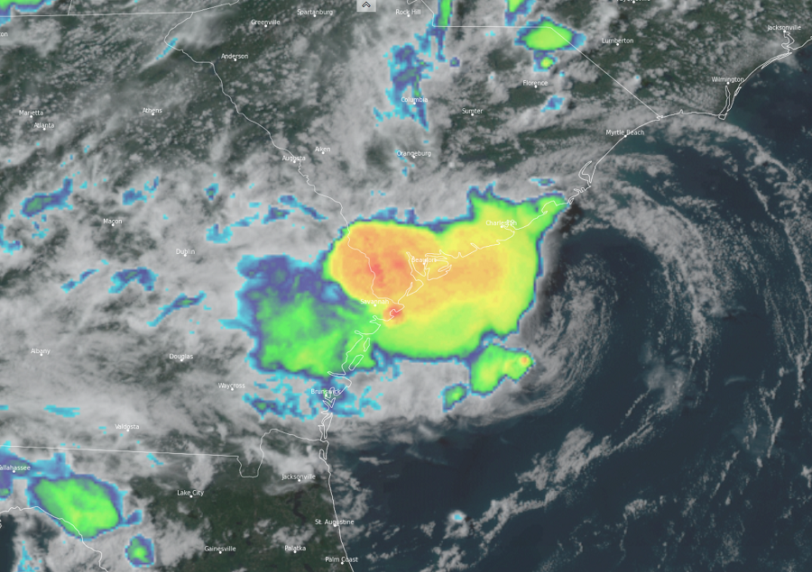
Danny, the fourth named storm of the 2021 Atlantic Hurricane Season, is currently located near latitude 32.3 North and longitude 80.1 West. Moving west-northwest at 16 mph, the system has maximum sustained winds of 45 mph. As the storm moves over land in South Carolina, it is forecast to rapidly weaken.
For now, a Tropical Storm Warning is in effect for the South Carolina coast from Edisto Beach to South Santee River. A Tropical Storm Warning means that tropical storm conditions are expected somewhere within the warning area, in this case within the next 6 hours.
After moving completely into South Carolina this evening, the National Hurricane Center (NHC) says Danny will move into east-central Georgia late tonight and early Tuesday morning. Hazards will follow Danny as it moves west into the southeast.
Tropical storm-force wind conditions are expected to first reach the coast within the warning area very soon making outside preparations difficult or dangerous.

Danny could produce 1-3″ of rainfall with locally higher amounts along the immediate coasts of Georgia and southern South Carolina. This region has been dry, limiting potential widespread flooding impacts, however, local flooding impacts, especially in urban areas along the southern South Carolina and Georgia coasts, cannot be ruled out at this time. Farther inland, 1-2″ of rainfall is possible across Upstate South Carolina, the Piedmont of Georgia, and into northeastern Alabama.
The combination of storm surge and the tide will cause normally dry areas near the coast to be flooded by rising waters moving inland from the shoreline. The water could reach up to 1-3′ above ground from Port Royal Sound to South Santee River in South Carolina. Surge-related flooding depends on the relative timing of the surge and the tidal cycle, and can vary greatly over short distances.
The NHC also warns that isolated tornadoes are possible this evening along the South Carolina coast as Danny moves inland.
