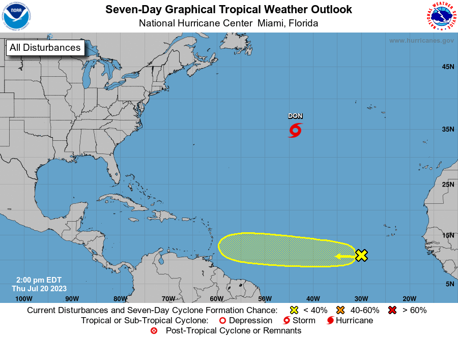
The National Hurricane Center is issuing advisories on Tropical Storm Don, located over the central Atlantic far from land. But the NHC is also keeping an eye on a tropical wave in the eastern Atlantic that could develop over time.
As of the latest advisory from the NHC, Don was located about 955 miles west of the Azores. With maximum sustained winds of 50 mph and a minimum central pressure of 1002 mb or 29.59″, the tropical storm was moving to the west-northwest at 10 mph.
Don is expected to continue moving west-northwest through Friday, with an eventual turn to the northwest expected by Friday night, followed by a northward turn over the weekend. On this path, Don should stay away from both the northeastern United States and eastern Canada as it curves away.
Little change in strength is forecast during the next couple of days and weakening is forecast to begin later this weekend.
While Don spins, the NHC is keeping an eye on a tropical wave located a few hundred miles southwest of the Cabo Verde Islands. This wave is currently interacting with the Intertropical Convergence Zone, which is producing an elongated area of showers and thunderstorms over the eastern and central tropical Atlantic. The NHC says that while dry air to the north may prevent significant organization during the day or two, environmental conditions could become more conducive for some development later this weekend as the system moves westward across the central tropical Atlantic. Any development that does occur will do so slowly; the NHC says there’s a near-zero chance of formation over the next 48 hours which grows to only 20% over the next 7 days.