A new tropical storm may be forming in the Atlantic; even if the tropical depression doesn’t get stronger, Bermuda will see gusty winds and some rain.
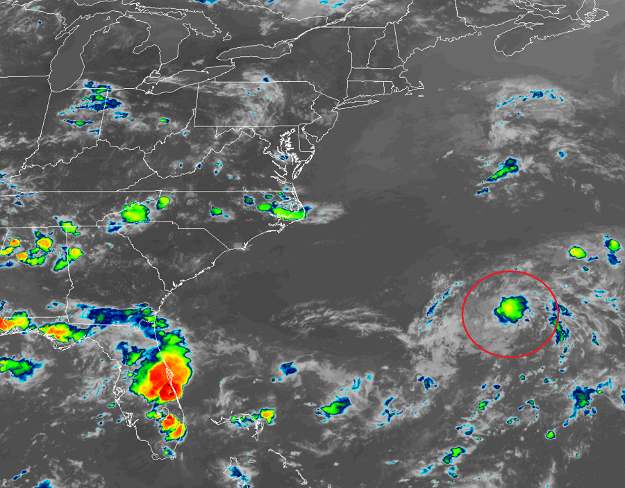
Earlier today the National Hurricane Center in Miami, Florida declared an organized area of clouds, showers, and storms as the season’s latest tropical depression. They believe the system could gain strength later tonight or early tomorrow and become the Atlantic season’s fifth named storm, Edouard.
If this system becomes a named storm, it’ll be the earliest 5th Atlantic named storm formation on record. The record for earliest fifth named storm is 2005’s Emily which formed on July 12 of that year.
According to the last advisory from the National Hurricane Center, the center of Tropical Depression Five was located near latitude 31.8 North, longitude 67.3 West. The depression is moving toward the east-northeast near 16 mph. Maximum sustained winds are around 35 mph with higher gusts; the estimated minimum central pressure is 1007 mb or 29.74 inches.
Based on the latest forecast track from the National Hurricane Center, the center of the depression will move near or just northwest and north of Bermuda tonight and early Sunday. Even if it doesn’t become a tropical storm, Tropical Depression Five could cause gusty conditions on Bermuda and over the nearby waters later today or tonight. Because of that threat, the Bermuda Weather Service has issued a Gale Warning. Because the system is small, most rain will be on the light side; generally, under an inch is expected on Bermuda but it is possible for some isolated areas to get up to 3″ if a heavier shower moves through.
The storm is of no direct threat to the United States. Beyond brushing by Bermuda, the system is expected to continue a north and east journey over the open waters of the Atlantic, degenerating into a post-tropical storm by later Monday.
