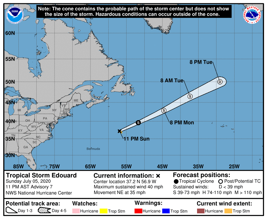
Tropical Storm Edouard has formed in the Atlantic, becoming the earliest “E” storm on record in the basin by many days. The storm, located north and east of Bermuda, is expected to continue heading over open waters of the Atlantic before degenerating with time. Other than fishing and shipping interests, Edouard should be of no concern to land.
In the latest update from the National Hurricane Center in Miami, Florida, the center of Tropical Storm Edouard was located near latitude 37.2 North, longitude 56.9 West. Edouard is moving toward the northeast near 35 mph with maximum sustained winds of around 40 mph. The estimated minimum central pressure is 1008 mb or 29.77 inches.
The National Hurricane Center expects little significant change in strength tonight before Edouard becomes a post-tropical system tomorrow. The National Hurricane Center’s Eric Blake wrote in the latest forecast discussion that “Extratropical transition is anticipated by 24 hours due to forcing from a middle latitude trough and a frontal boundary. Some minor strengthening of Edouard due to the transition process is possible over the next day or so before the global models show a gradual weakening.”
With Tropical Depression #5 now upgraded to Tropical Storm Edouard, it has broken the record as being the earliest fifth named storm in the Atlantic to form; the previous record for earliest fifth named storm is 2005’s Emily which formed on July 12 of that year.
While Edouard won’t impact the United States, the National Hurricane Center is monitoring another low pressure system in the northeastern Gulf of Mexico that could become problematic this week. A small low pressure system located about 100 miles south-southwest of Panama City, Florida could see additional development before moving inland tomorrow. However, this system is expected to evolve into a larger low pressure system and move northeastward over time, possibly emerging offshore of the Carolinas later this week. When it does so, the National Hurricane Center believes environmental conditions could be conducive for development. Computerized global forecast guidance is suggesting that a tropical depression or storm could form, possibly impacting portions of the Mid Atlantic or New England coasts by the end of the upcoming week.
If this east coast system were to get a name, it would be called Fay. It too would also be the earliest on record that the 6th named storm has formed in any Atlantic Hurricane Season.