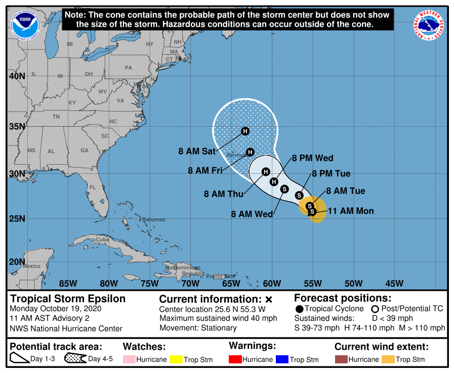
The National Hurricane Center is forecasting that newly formed Tropical Storm Epsilon will become a hurricane by Wednesday afternoon, possibly bringing direct or indirect impacts to Bermuda before the end of the week. When Epsilon formed earlier today, it became the earliest 26th named storm to ever form in the Atlantic Hurricane Basin on record; the prior storm’s record was on November 22, 2005. This is only the second time has the Greek letter “Epsilon” been used to name a storm; the first time was in 2005 too.
Located roughly 735 miles southeast of Bermuda, Epsilon is currently located near 25.6 N, 55.3 W. With maximum sustained winds of 40 mph and a minimum central pressure of 1000 mb, Epsilon is a minimal tropical storm for now. However, that is forecast to change over the next 48 hours. For now, Epsilon is
stationary and little overall motion is expected through tonight. According to the National Hurricane Center, a slow west-northwestward to northwestward motion should begin on Tuesday, and this motion should continue through midweek. As that motion takes shape, gradual strengthening is forecast during the next 72 hours, and Epsilon is forecast to be at or near hurricane strength by early Thursday.
While Epsilon is forecast to head in the general direction of the northeastern United States in the coming days, an approaching cold front from the west should help carry Epsilon out to sea away from the U.S. and Canadian East Coast. Until that happens though, residents should keep an eye on this developing tropical cyclone. Even if the storm doesn’t approach the coast, it could still send large swells, rough seas, and dangerous rip currents to portions of the east coast with time.