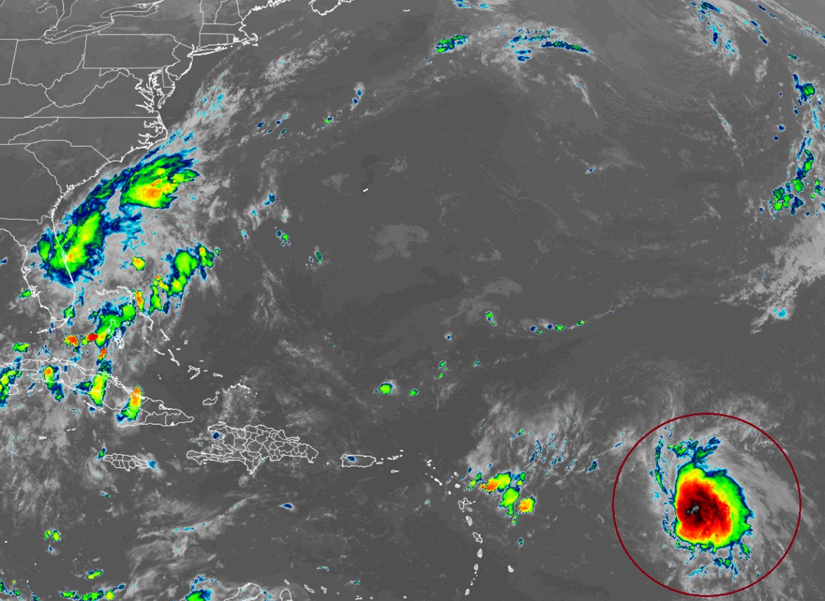
Tropical Storm Fiona forms: the National Hurricane Center just upgraded Tropical Depression #7 to the 6th named storm of the 2022 Atlantic Hurricane Season. According to the National Hurricane Center (NHC), satellite data indicates that the depression has strengthened to a tropical storm with maximum winds estimated to be near 50 mph. The storm is roughly 645 miles east of the Leeward Islands and is moving west at 14 mph. The minimum central pressure is 1002 mb or 29.59″.
There are no Tropical Storm Watches or Warnings up at this time; however, the National Hurricane Center (NHC) says that interests in the Leeward Islands, the Virgin Islands, and Puerto Rico should monitor the progress of this system. Tropical storm watches will likely be required for portions of the Leeward Islands later tonight or early tomorrow.
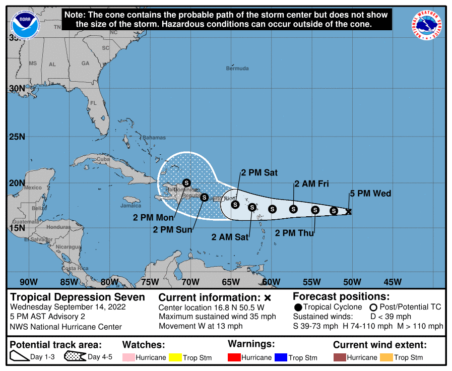
For now, the NHC expects this storm system to continue to move west for the next few days before turning more northwest with time. On the forecast track, the center of the system is forecast to move through the Leeward Islands late Friday and Friday night, and be near the Virgin Islands and Puerto Rico this weekend. As it heads west, the NHC expects some gradual strengthening during the next day or so.
While it is likely this storm will impact the United States by way of the Virgin Islands and Puerto Rico, it is too soon to tell whether or not the mainland U.S. will see direct or indirect impacts. While the European ECMWF computer forecast model gradually curves this system out to sea, the American GFS computer forecast brings this storm dangerously close to the Mid Atlantic and New England coasts with time. Over the next week, these forecasts will be refined and the NHC will have a better idea of where the storm will go once it passes through or near Puerto Rico. Even if the storm doesn’t directly impact the U.S. mainland, it could still generate life-threatening swells and rough surf up and down the East Coast.
