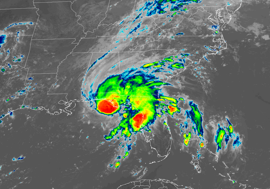
Tropical Storm Fred is making landfall on the Florida panhandle now, bringing heavy rains, strong winds, and a high storm surge to portions of the coast. While impacts will be felt along the Gulf coast today, Fred could pose serious risk of floods to a broad area of the eastern United States in the coming days.
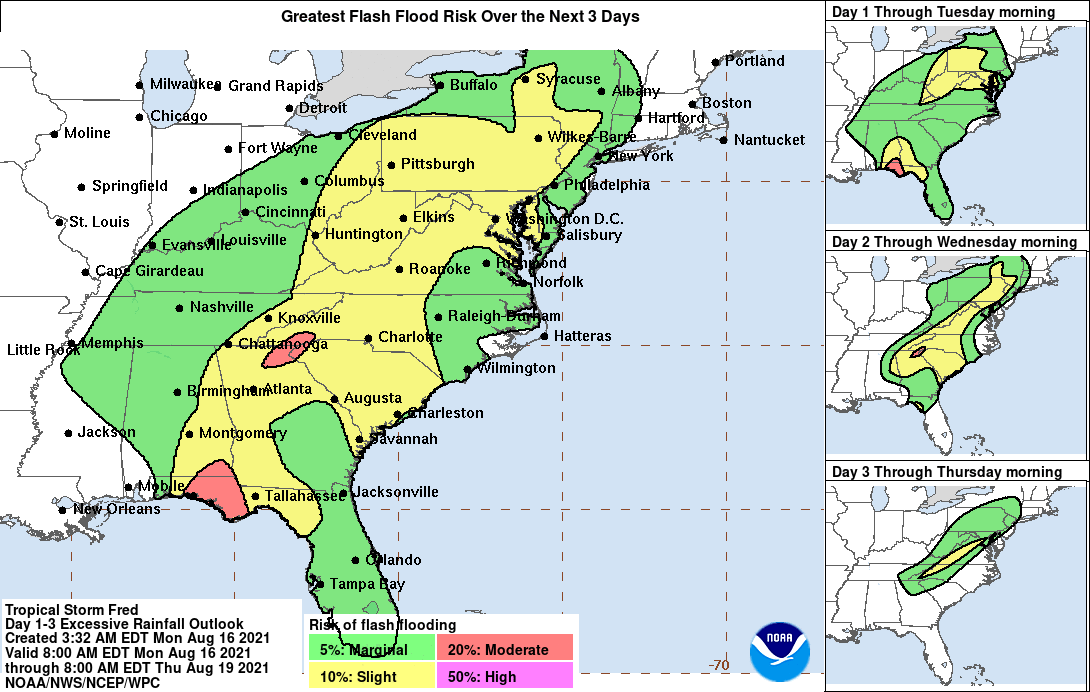
According to the National Hurricane Center, through Tuesday, heavy rainfall may lead to flash, urban, small stream, and isolated river flooding impacts across the Southeast. By the middle of the week as Fred lifts north and inland, heavy rainfall and flooding will impact the southern and central Appalachians, the Piedmont of the Southeast and Mid-Atlantic. Landslides are also possible across the mountains of North Carolina and Blue Ridge Escarpment on Tuesday.
The National Hurricane Center also expects dangerous storm surge inundation along portions of the coast of the Florida Panhandle and the Florida Big Bend region today. A peak storm surge of 3-5′ is possible from Indian Pass, Florida to the Steinhatchee River. Surge-related flooding depends on the relative timing of the surge and the tidal cycle and can vary greatly over short distances.

While tropical storm conditions are occurring in the warning area and will spread farther inland later today and tonight across portions of the Florida Panhandle, southwestern Georgia, and southeastern Alabama.
The moisture from Fred will combine with a front in the southeast, dropping copious amounts of rain from Florida north to upstate New York over the next four days. New York, New Jersey, Pennsylvania, Maryland, West Virginia, Virginia, North Carolina, South Carolina, Tennessee, Georgia, Alabama, and Florida could all see flooding rains from this storm as it and its remnants move north and east with time.