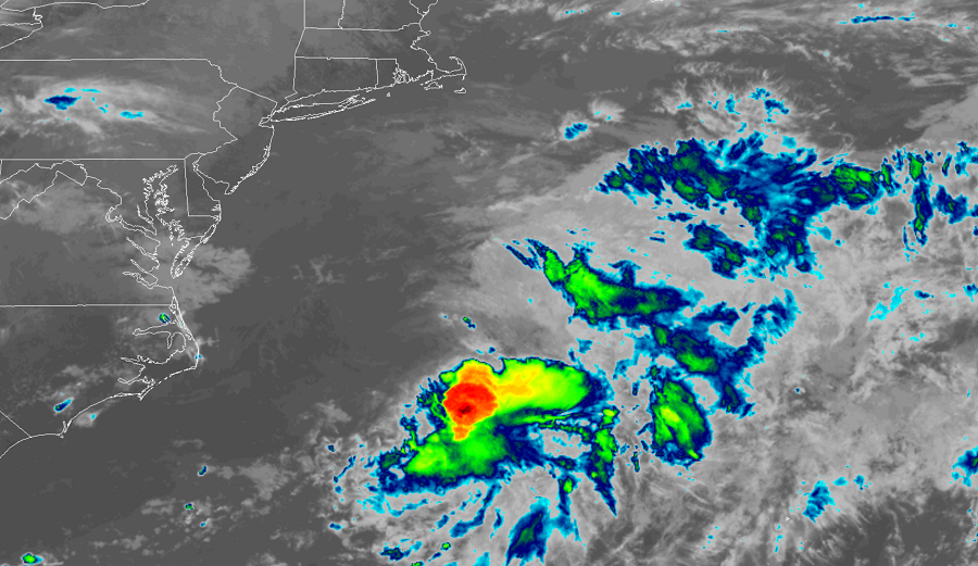
The 15th tropical depression of the Atlantic Hurricane Basin has been upgraded to Tropical Storm Omar, becoming the earliest ever on record that an “O” storm formed in the basin. At 5pm ET, Omar was located about 225 miles east of Cape Hatteras, North Carolina; with maximum sustained winds of 40 mph, it was moving to the east north east at 15 mph. The estimated minimum central pressure is 1007 mb or 29.74 inches.
The previous earliest “O” storm was Ophelia which formed on September 7 in 2005.
Fortunately, Omar is not expected to bring any direct impacts to land; as such, there are no coastal watches or warnings in effect. Omar is forecast to continue moving to the east-northeast through tomorrow, followed by a turn toward the east by Thursday. On the forecast track, Omar will continue to move away from the United States, traveling well north of Bermuda and well south of Canada. Little change in strength is expected overnight, following by weakening beginning on Wednesday night. On Thursday, Omar is forecast to degenerate into a remnant area of low pressure by late in the day.
Omar joins Nana as the only two named storms in the Atlantic hurricane basin today.