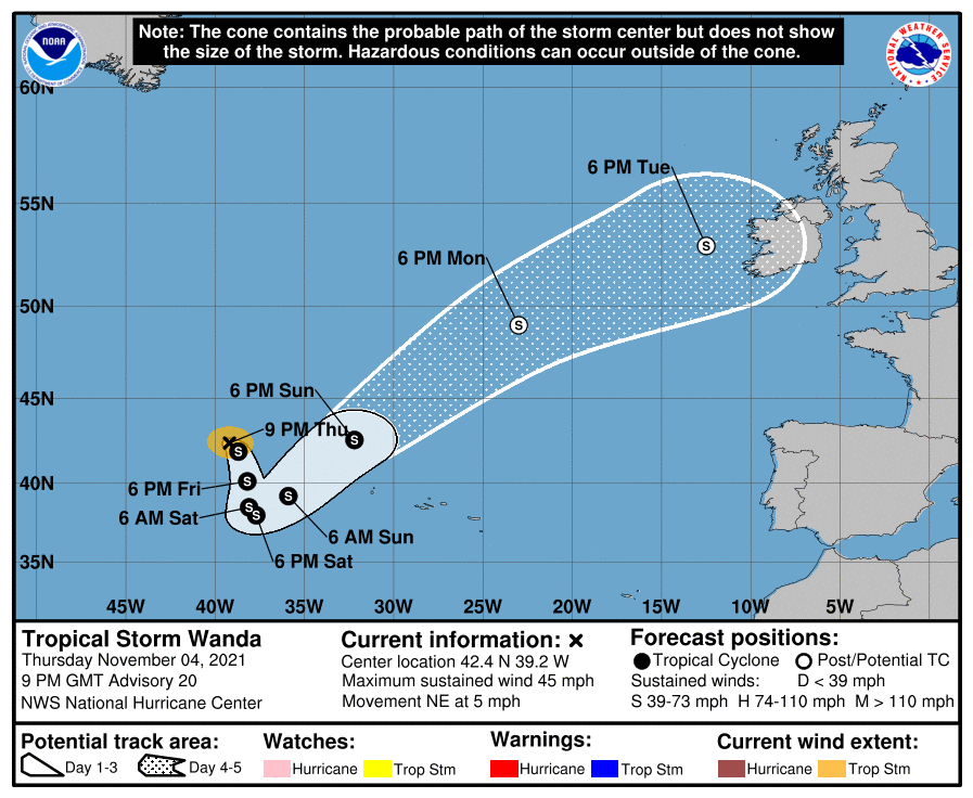
While Europe often sees the remnants of tropical cyclones in the Atlantic, it is very rare for a tropical storm or subtropical storm from the Atlantic Hurricane Basin to maintain its structure and impact Europe. It appears Tropical Storm Wanda may be such a storm to impact Europe, with the National Hurricane Center (NHC) suggesting impacts from the cyclone as early as Tuesday afternoon based on their latest forecast cone.
As of the latest update from the NHC, Tropical Storm Wanda was spinning about over the open waters of the North Atlantic. Centered at 42.4 N 39.2 W, Wanda is located about 710 miles west-northwest of the Azores. It was moving northeast at 5 mph while packing 45 mph maximum sustained winds. Estimated minimum central pressure is down to 994 mb.
For now, the National Hurricane Center expects Wanda to spin about over the open Atlantic; however, with time, it could head straight for Ireland. While little change in strength is expected through Friday, the NHC expects slow strengthening Friday night and Saturday. Their latest official forecast calls for Wanda to transition from a tropical storm to a post-tropical cyclone on Monday. Beyond that, Wanda could head to Ireland where wind-whipped heavy rains could be possible Tuesday into Wednesday.
For now, because Wanda is of no immediate threat to any land, no advisories tied to the system are up anywhere in the Atlantic or Europe at this time.