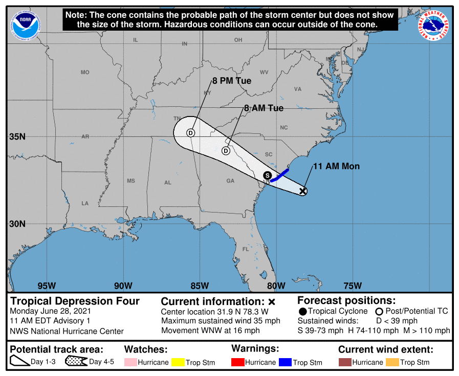
After being monitored by the National Hurricane Center (NHC) for signs of potential development over the last 48 hours, it looks like the coastal storm in question is quickly becoming a tropical storm; as such, Tropical Storm Warnings are now up for a portion of the U.S. East Coast. Even beyond the Tropical Storm Warning area, heavy rains and gusty breezes are likely.
The storm in question is roughly 145 miles east-southeast of Beaufort, South Carolina and about 110 miles east-south-east of Charleston, South Carolina. Maximum sustained winds are at 35 mph while the minimum central pressure is at 1013 mb or 29.92″. The storm is moving to the west-northwest at 16 mph.
A Tropical Storm Warning has been issued for a portion of the coast of South Carolina from Edisto Beach northeastward to South Santee River. A Tropical Storm Warning means that tropical storm conditions are expected somewhere within the warning area, in this case within the next 12 hours.
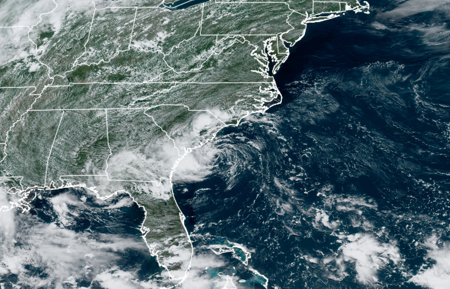
According to the NHC, the storm is expected to continue to move west-northwest over the next few days, making landfall along the South Carolina coast in the Tropical Storm Warning area this evening.
While the system’s 35 mph winds only make it a tropical depression for now, the NHC does expect it to reach Tropical Storm strength right before it makes landfall. When that happens, the system would earn the name Danny. The NHC says rapid weakening is forecast after landfall occurs; however, heavy rains will linger even after it weakens.
Strong winds, heavy rain, and storm surge flooding are all possible from the storm. Tropical storm conditions are about to first reach the coast within the warning area by late this afternoon, making
outside preparations difficult or dangerous. The system could produce 1-3″ of rainfall with locally higher amounts along the immediate coasts of Georgia and southern South Carolina. This region has been dry, limiting potential widespread flooding impacts, however, local flooding impacts, especially in urban areas along the southern South Carolina and Georgia coasts, cannot be ruled out at this time. Farther inland, 1-2″ of rainfall is possible across Upstate South Carolina, the Piedmont of Georgia, and into northeastern Alabama. The combination of storm surge and the tide will cause normally dry areas near the coast to be flooded by rising waters moving inland from the shoreline. The water could reach 1-3′ high above ground from Port Royal Sound to South Santee River in South Carolina if the peak surge occurs at the time of high tide. Surge-related flooding depends on the relative timing of the surge and the tidal cycle, and can vary greatly over short distances.
