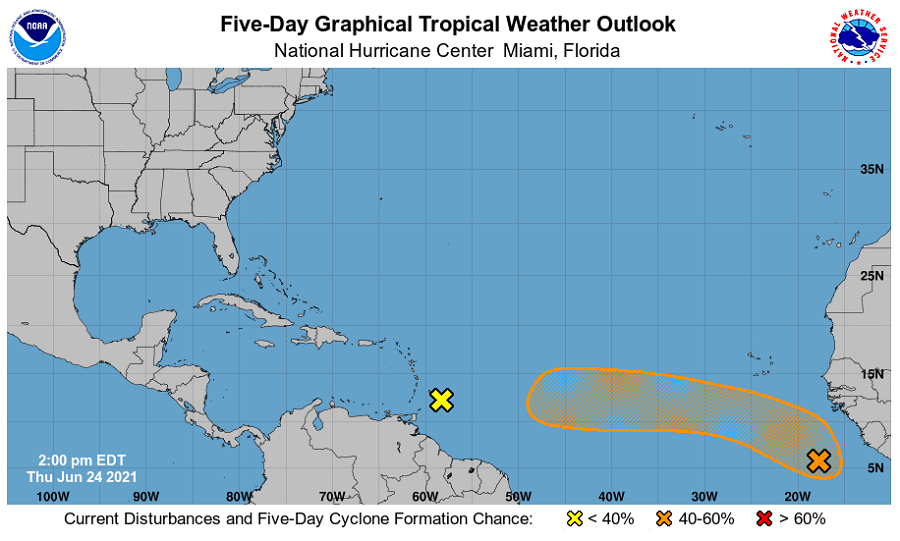
The National Hurricane Center (NHC) in Miami, Florida is monitoring a disturbance over the eastern Atlantic; it’s possible some tropical trouble can be brewing there. The site for possible trouble is intriguing: during this part of the Atlantic hurricane season, most tropical disturbances take place closer to the U.S. around the Gulf of Mexico or Caribbean. It is usually not until later in the season in August and September that storms will take shape off the African continent.
According to the NHC’s latest Tropical Outlook, a strong tropical wave located over the far east Atlantic off the African coast is producing a broad area of showers and thunderstorms. As the system moves west-northwestward into the central Atlantic Ocean, conditions appear only marginally conducive for development due to relatively cool ocean temperatures. However, the NHC says a small tropical depression could still form by early next week. Beyond then, it could move over warmer waters which could be more conducive for additional development.
Right now, the NHC says there’s only a low 20% chance of tropical cyclone formation over the next 48 hours but that grows to a medium 40% over the next 5 days.
June has been busy with Tropical Storm Bill and Claudette in recent weeks. Only 4 years on record have had three Atlantic named storm formations in June: 1886, 1909, 1936 and 1968. If this next system develops, it could set some records. Only three named storms have formed in tropical Atlantic in the area south of 20°N and east of 60°W in June on record: Storm #2 in 1933, Ana in 1979, and Bret in 2017.