While we are now past the peak of the 2020 Atlantic Hurricane Season, we are not yet out of the woods. The season doesn’t officially end until the end of November. And it appears a new system could be taking shape in the Atlantic in the coming days.
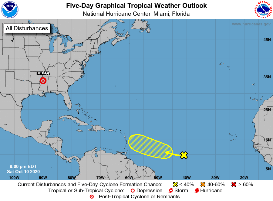
Meteorologists with the National Hurricane Center are tracking the disturbance in the central Atlantic. According to the latest Tropical Outlook they released, a westward-moving tropical wave is producing disorganized showers and thunderstorms over the central tropical Atlantic. The National Hurricane Center says some slow development of this system is possible later this weekend or early next week while the wave continues moving westward at around 15 mph. However, the National Hurricane Center also says they believe upper-level winds are forecast to become unfavorable for further development by the middle of next week.
Beyond the National Hurricane Center, computer forecast guidance that they and other meteorologists use have been suggesting that additional tropical cyclones could form over the next 10 days near Florida, the Gulf Coast, and the East Coast. However, such guidance has yet to be consistent, giving forecasters low confidence in the accuracy of their mid-range forecast guidance.
October is no stranger to severe tropical cyclones. In 2018, Hurricane Michael hit Florida as a Category 5 hurricane on October 10. In 2012, Sandy struck the New Jersey Coast as a powerful cyclone in transition from tropical to non-tropical. Even though Sandy wasn’t a hurricane, it was one of the costliest disasters to strike New Jersey and New York, claiming many lives in the process. Sandy struck New Jersey on October 29.
With the traditional list of names exhausted, the National Hurricane Center is using Greek letters to name tropical storms and hurricanes. The next system to earn a name this season will be called Epsilon. After Epsilon would be Zeta followed by Eta. The 2005 Atlantic hurricane season was the busiest on record; it produced a Tropical Storm Zeta in December. But a Greek letter beyond Zeta has never been used before; it remains to be seen if Eta or others will be used for the first time in 2020.
