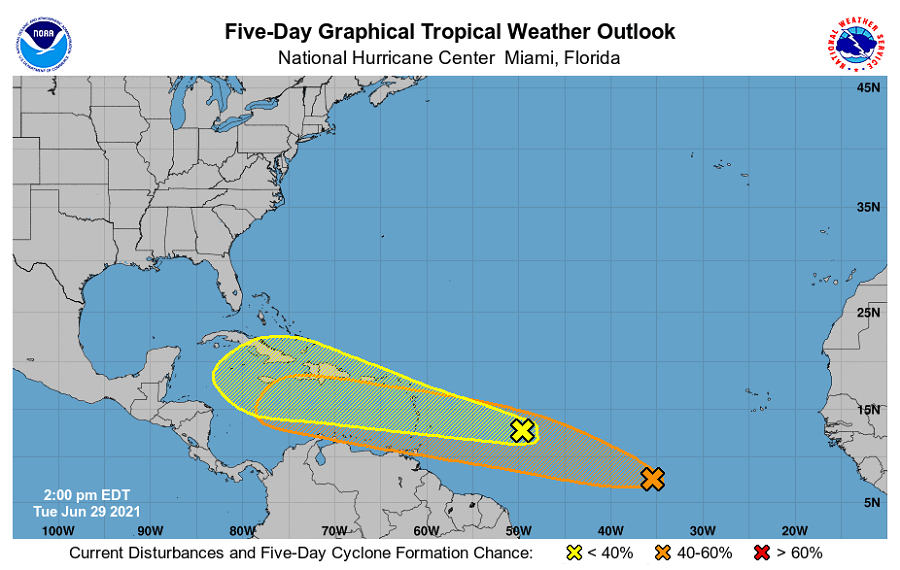
The National Hurricane Center (NHC) in Miami, Florida is tracking two potential areas of trouble in the Atlantic hurricane basin; with time, these systems could develop into tropical cyclones. While they aren’t an immediate threat to the United States, that could change in about 5+ days. The NHC issued a Tropical Outlook for both of these
The first system today consists of an area of disorganized showers and thunderstorms forming in association with a tropical wave located over the tropical Atlantic about 650 miles east of the Lesser Antilles. According to the NHC, some slow development of this disturbance is possible later this week while the system moves westward to west-northwestward at 20 to 25 mph, likely reaching the Lesser Antilles by Wednesday night. Regardless of development, the NHC says that this system could bring locally heavy rainfall to portions of the Lesser Antilles during the next few days. For now, the NHC says there’s a 20% chance of tropical cyclone formation over the next 48 hours and that grows to 30% over the next five days.
The second system has higher odds of becoming a tropical cyclone with time. Shower activity associated with a tropical wave located about 900 miles southwest of the Cabo Verde Islands has caught the eye of the NHC. They say this area continues to show signs of organization and they say additional development of this system is possible during the next several days as it moves generally west-northwestward at about 20 mph. While development chances are a low 20% for the next 48 hours, they grow to a medium 40% over the next 5 days.
Based on the current weather pattern, these systems, and at least their moisture, could make their way to the United States coastline with time. However, any such threat to U.S. land would occur after the 4th of July holiday.
The Atlantic Hurricane Season runs now through end of November. Most tropical cyclones in this basin form in September during the season.